Canjadude
Appearance
Canjadude | |
|---|---|
Village | |
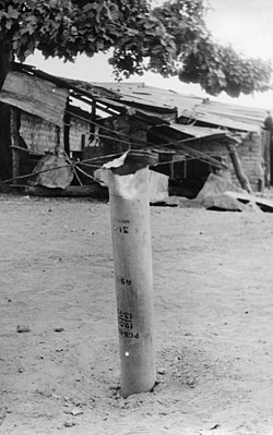
 PAIGC missile in the former Portuguese army barracks of Canjadude, 1973 | |
| Country | |
| Region | Gabú Region |
| Sector | Piche |
| Time zone | UTC+0 (GMT) |
Canjadude is a village in the Gabú Region of north-eastern Guinea-Bissau. It lies to the south of Uelíngarà.[1][2] Canjadude, along with Catió and other camps were besieged by the Portuguese in 1973.[3]
References
- ^ Google Maps (Map). Google.
{{cite map}}:|access-date=requires|url=(help) - ^ Bing Maps (Map). Microsoft and Harris Corporation Earthstar Geographics LLC.
{{cite map}}:|access-date=requires|url=(help) - ^ Translations on Sub-Saharan Africa, Issues 1390-1397. United States. Joint Publications Research Service. 1973. p. 29.
External links
