Caseara
Appearance
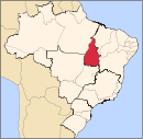
Template:Infobox Municipality BR Caseara is a municipality located in the Brazilian state of Tocantins. Its population was 5,119 (2015) and its area is 1,692 km².[1]
The municipality contains 10.66% of the 1,678,000 hectares (4,150,000 acres) Ilha do Bananal / Cantão Environmental Protection Area, created in 1997.[2] The headquarters and visitor center of Cantão State Park are located just outside the town of Caseara. The municipality plans to open a hiking/bicycle trail from the town center to the park's visitor center in 2014.
References
- ^ IBGE - [1]
- ^ APA Leandro (Ilha do Bananal/Cantão) (in Portuguese), ISA: Instituto Socioambiental, retrieved 2016-10-31

