Cauldwell, Derbyshire
Appearance
| Cauldwell | |
|---|---|
 Cauldwell | |
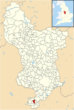
 Cauldwell parish highlighted within Derbyshire | |
| OS grid reference | SK255172 |
| District | |
| Shire county | |
| Region | |
| Country | England |
| Sovereign state | United Kingdom |
| Post town | SWADLINCOTE |
| Postcode district | DE12 |
| Police | Derbyshire |
| Fire | Derbyshire |
| Ambulance | East Midlands |
Cauldwell (pronounced "Cordal") is a small village[disputed – discuss] and civil parish in South Derbyshire. Its streets are named Main Street, Church Lane and Sandy Lane. It has a school for children with special needs.
It is 4 miles south east of Burton on Trent and nearby settlements are Linton, Rosliston, Coton Park and Botany Bay.
See also
[edit]References
[edit]External links
[edit]![]() Media related to Cauldwell at Wikimedia Commons
Media related to Cauldwell at Wikimedia Commons
52°45′07″N 1°37′23″W / 52.752°N 1.623°W
