Chamlang
Appearance
| Chamlang | |
|---|---|
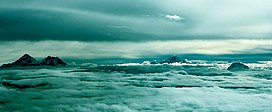
 From left to right: the peaks of Mount Everest and Lhotse, then Makalu, and Chamlang on the right side. | |
| Highest point | |
| Elevation | 7,319 m (24,012 ft)[1] Ranked 80th |
| Prominence | 1,193 m (3,914 ft)[1] |
| Coordinates | 27°46′32″N 86°58′47″E / 27.77556°N 86.97972°E[2] |
| Geography | |
| Location | Nepal |
| Parent range | Mahalangur, Himalayas |
| Climbing | |
| First ascent | 31 May 1962[3] |
Chamlang is a mountain in the Nepalese Himalayas, near Makalu. It lies in the southern section of the Mahalangur subrange of the Himalayas. Chamlang has an elevation of 7,319 metres (24,012 ft).
See also
References
- ^ a b "Chamlang, Nepal" Peakbagger.com. Retrieved 2012-01-08.
- ^ "Chamlang" Peakware.com. Retrieved 2012-01-08.
- ^ Seiki Nakano, Academic Alpine Club of Hokkaido (1963). "Asia, Nepal, Chamlang". Alpine Journal. Retrieved 14 October 2017.

