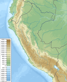
Lake Chilicocha
Appearance
| Chiliqucha | |
|---|---|
| Location | Peru Huancavelica Region |
| Coordinates | 12°41′14″S 75°24′34″W / 12.68722°S 75.40944°W |
| Chiliqucha Dam | |
|---|---|
| Country | Peru |
| Dam and spillways | |
| Height | 4 m (13 ft) |
| Power Station | |
| Operator(s) | Electroperu |
Chiliqucha (in the local (Wanka Quechua) pronunciation variant where r is often pronounced as l) or Chiriqucha (Southern Quechua chiri cold, qucha lake,[1] "cold lake", hispanicized spelling Chilicocha) is a lake in Peru located in the Huancavelica Region, Huancavelica Province, Acobambilla District. Chiliqucha lies southeast of Aqchiqucha and Anqasqucha. The mountain at the western shore of Chiliqucha is named Wilaqucha (or Wiraqucha in Southern Quechua). The lake belongs to the watershed of the Mantaro River.[2][3]
The Chiliqucha dam was built in 1999. It is 4 m (4.4 yd) high. It is operated by Electroperu.[3]
References
- ^ Teofilo Laime Ajacopa (2007). Diccionario Bilingüe: Iskay simipi yuyayk’anch: Quechua – Castellano / Castellano – Quechua (PDF). La Paz, Bolivia: futatraw.ourproject.org.
- ^ escale.minedu.gob.pe - UGEL map of the Huancavelica Province (1) (Huancavelica Region)
- ^ a b Obras hidraulicos en la cuenca de Mantaro - fuente : fuente: Electroperu - Inventario proyectos de afianzamiento hidrico Cuenca del Rio Mantaro, 2005

