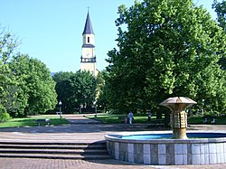
Chlumec (Ústí nad Labem District)
Appearance
Chlumec | |
|---|---|
Municipality | |
 | |
| Coordinates: 50°41′50″N 13°56′20″E / 50.69722°N 13.93889°E | |
| Country | |
| Region | Ústí nad Labem |
| District | Ústí nad Labem |
| Area | |
• Total | 12.87 km2 (4.97 sq mi) |
| Elevation | 235 m (771 ft) |
| Population (2006) | |
• Total | 4,402 |
| • Density | 340/km2 (890/sq mi) |
| Postal code | 400 10 to 403 39 |
| Website | http://www.ouchlumec.cz/ |
Chlumec (Template:Lang-de) is a village and municipality (obec) in Ústí nad Labem District in the Ústí nad Labem Region of the Czech Republic.
The municipality covers an area of 12.87 km2, and has a population of 4,402 (as at 28 August 2006).
Chlumec lies approximately 9 km north-west of Ústí nad Labem and 76 km north-west of Prague.
After the great Battle of Dresden[1] (26–27 August 1813), the Battle of Kulm took place here on 29–30 August, between the French Empire under Dominique Vandamme and an allied army of Austrians, Prussians, and Russians. The French were defeated and Vandamme surrendered with his army of 10,000 men. The heights above Kulm were the site of the Second Battle of Kulm, 17 September 1813.
References
- ^ Chronologie des civilisations, Jean Delorme, Presses universitaires de France, 1956
External links
Wikimedia Commons has media related to Chlumec (Ústí nad Labem District).


