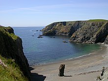
Copper Coast Geopark

The Copper Coast Geopark is a designated area comprising a stretch of the southern coast of Ireland in County Waterford, extending for some 17 km from Kilfarrasy in the east to Stradbally in the west. It was the first geopark designated in the state, and the second on the island.
History
The coast, and the geopark, are named for the historic metal-mining industry, the legacies of which now constitute a tourist attraction. The idea of the geopark developed from a local interest group, starting around 1997.
The area was declared a European Geopark in 2001 and a UNESCO Global Geopark in 2004. This was done to aid in sustainability but also with a hope of boosting the profile of the area as a tourist destination.
Features
This geologically diverse area contains records of Palaeozoic volcanism and the last ice age - a heritage which is interpreted locally for the visitor.
The geopark trust maintains a visitor centre at Monksland Church in Knockmahon.[1] It also owns an old engine house, part of the industrial heritage.
Organisation
The geopark is overseen by a charitable company, with voluntary local and expert directors, and a staff of a part-time manager and a geologist, supported by volunteer guides, and community employment workers from Solas and Tus.
References

