Crosby, Cumbria
Appearance
| Crosby | |
|---|---|
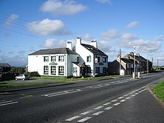
 The Stag Inn, Crosby | |
Location within Cumbria | |
| OS grid reference | NY074384 |
| Civil parish | |
| District | |
| Shire county | |
| Region | |
| Country | England |
| Sovereign state | United Kingdom |
| Post town | MARYPORT |
| Postcode district | CA15 |
| Dialling code | 01900 |
| Police | Cumbria |
| Fire | Cumbria |
| Ambulance | North West |
| UK Parliament | |
Crosby is a small village in Cumbria, England, three miles north-east of Maryport on the A596 road. It has a population of approximately 1000. The local primary school is Crosscanonby St. John's Church of England School. The only remaining public house in the village is The Stag Inn.
External links
![]() Media related to Crosby, Cumbria at Wikimedia Commons
Media related to Crosby, Cumbria at Wikimedia Commons

