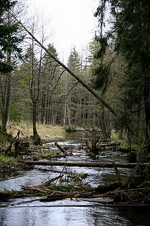
Czarna Hańcza
Appearance

The Czarna Hańcza, Čornaja Hanča (Template:Lang-be, Template:Lang-lt) is the largest river of the Suwałki Region of north-eastern Poland and the Sapockin region of north-western Belarus. It is known for having large postglacial boulders. Originating near Lake Hańcza (the deepest lake in Poland with the maximum depth of 108.5 m) and flowing through lake Hańcza and Wigry Lake (the location of Poland's Wigry National Park), it is a tributary of the Neman River beyond the borders of Belarus and Lithuania.[1][2]
See also
- Augustów Canal
- Biała Hańcza
 Media related to Czarna Hańcza at Wikimedia Commons
Notes and references
- ^ "Klasyfikacja jakości wód płynących województwa podlaskiego - stan na 31.12.2004" (PDF file, direct download) (in Polish). WIOŚ Białystok. Retrieved February 3, 2013.
- ^ Jerzy Nalepa, Jaćwięgowie. Nazwa i lokalizacja, Wydawnictwo Naukowe PWN, Warszawa 1964, s.7. Template:Pl icon
