
De Vink railway station
Station De Vink | |||||||||||||||
|---|---|---|---|---|---|---|---|---|---|---|---|---|---|---|---|
 | |||||||||||||||
| General information | |||||||||||||||
| Location | Netherlands | ||||||||||||||
| Coordinates | 52°08′45″N 4°27′28″E / 52.14583°N 4.45778°E | ||||||||||||||
| Operated by | Nederlandse Spoorwegen | ||||||||||||||
| Line(s) | Amsterdam–Rotterdam railway | ||||||||||||||
| Platforms | 2 | ||||||||||||||
| Other information | |||||||||||||||
| Station code | Dvnk | ||||||||||||||
| History | |||||||||||||||
| Opened | 1906, reopened 1985 | ||||||||||||||
| Closed | 1928 | ||||||||||||||
| Services | |||||||||||||||
| |||||||||||||||
De Vink is a railway station in the Netherlands. It is located near the former hamlet of De Vink, currently a part of Leiden.
The station re-opened in 1985. It is wedged in between the city of Leiden and the neighbouring town of Voorschoten. The tracks in the direction of The Hague are on Leiden ground. The tracks in the direction of Leiden are on Voorschoten ground. Because of this, it is currently the only railway station in the Netherlands not to feature the name of the city it is located in.
Train services
The following services call at De Vink:
- 2x per hour local service (sprinter) The Hague - Leiden - Schiphol - Duivendrecht - Hilversum - Utrecht
- 2x per hour local service (stoptrein) The Hague - Leiden - Haarlem
Gallery
-
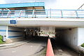 Station De Vink
 -
 Monument near Station De Vink (by Cune van Groeningen)
 -
 Goddess Sibyl near Station De Vink


