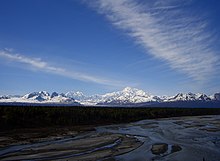
Denali State Park
Appearance
| Denali State Park | |
|---|---|
 | |
 | |
| Type | Wilderness |
| Location | 147.1 Parks Highway, north of Trapper Creek[1] |
| Coordinates | 62°44′21″N 150°06′48″W / 62.73917°N 150.11333°W[2] |
| Opened | 1970 (expanded to present size in 1976) |
| Operated by | Alaska State Parks |
Denali State Park is a 325,240 acre (1,316.2 km²) state park in the U.S. state of Alaska. It is located adjacent to the east side of Denali National Park and Preserve, along the Parks Highway.

The park is undeveloped wilderness with the exception of the two day-use areas, three campgrounds, and two trailheads accessible from the Parks Highway:[1]
- Alaska Veterans Memorial
- Denali Viewpoint South
- Byers Lake Campground, near Byers Lake
- Denali Viewpoint North Campground
- Lower Troublesome Creek Campground
- Upper Troublesome Creek Trail (closed in 2009 due to washouts caused by severe flooding)[3]
- Little Coal Creek Trail
See also
References
- ^ a b Alaska State Parks near Trapper Creek in the Susitna Valley
- ^ Denali National Park and Preserve - Aviation Reporting Coordinates (U.S. National Park Service)
- ^ The Milepost 61st Edition, page 406 ISBN 978-1892-15426-2
