
Erlau
Erlau | |
|---|---|
Location of Erlau within Mittelsachsen district 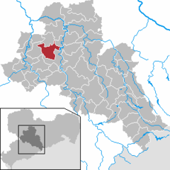 | |
 Erlau  Erlau | |
| Coordinates: 51°0′23″N 12°55′25″E / 51.00639°N 12.92361°E | |
| Country | Germany |
| State | Saxony |
| District | Mittelsachsen |
| Government | |
| • Mayor | Jürgen Kunath (CDU) |
| Area | |
| • Total | 37.75 km2 (14.58 sq mi) |
| Elevation | 320 m (1,050 ft) |
| Population (2022-12-31)[1] | |
| • Total | 3,126 |
| • Density | 83/km2 (210/sq mi) |
| Time zone | UTC+01:00 (CET) |
| • Summer (DST) | UTC+02:00 (CEST) |
| Postal codes | 09306 |
| Dialling codes | 03727 |
| Vehicle registration | FG |
| Website | www.gemeinde-erlau.de |
Erlau is a municipality in the district of Mittelsachsen in Saxony in Germany.
References
- ^ "Einwohnerzahlen nach Gemeinden als Excel-Arbeitsmappe" (XLS) (in German). Statistisches Landesamt des Freistaates Sachsen. 2024.
| International | |
|---|---|
| National | |
This Mittelsachsen location article is a stub. You can help Wikipedia by expanding it. |