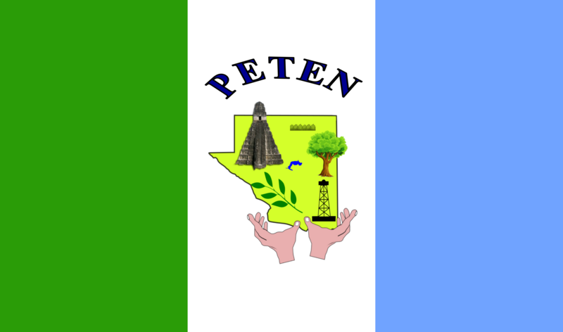
File:Bandera del Departamento El Petén.png
Appearance

Size of this preview: 800 × 472 pixels. Other resolutions: 320 × 189 pixels | 640 × 378 pixels | 1,024 × 605 pixels | 1,280 × 756 pixels | 2,788 × 1,646 pixels.
Original file (2,788 × 1,646 pixels, file size: 335 KB, MIME type: image/png)
File history
Click on a date/time to view the file as it appeared at that time.
| Date/Time | Thumbnail | Dimensions | User | Comment | |
|---|---|---|---|---|---|
| current | 18:21, 18 October 2022 |  | 2,788 × 1,646 (335 KB) | Moratoe | Se subió la imagen correcta debido a que la anterior correspondía a la del municipio de Flores perteneciente al mismo departamento. |
| 21:44, 11 May 2011 |  | 559 × 335 (21 KB) | AlexR.L. | {{Information |Description ={{en|1=El Petén Flag}} |Source ={{own}} |Author =AlexR.L. |Date =5/7/11 |Permission ={{self|cc-by-sa-3.0|GFDL}} |other_versions = }} Category:Departments of Guatemala |
File usage
The following 33 pages use this file:
- Departments of Guatemala
- Dolores, Guatemala
- El Chal, Petén
- Flag of Guatemala
- Flores, Petén
- Flores Island, Guatemala
- ISO 3166-2:GT
- La Libertad, Petén
- Las Cruces, Petén
- List of country subdivision flags in North America
- List of political and geographic subdivisions by total area (all)
- List of political and geographic subdivisions by total area from 20,000 to 50,000 square kilometers
- List of political and geographic subdivisions by total area from 30,000 to 50,000 square kilometers
- Melchor de Mencos
- Miss Guatemala 2009
- Miss Guatemala 2010
- Miss Guatemala 2011
- Petén Department
- Poptún
- San Andrés, Petén
- San Benito, Petén
- San Francisco, Petén
- San José, Petén
- San Luis, Petén
- Santa Ana, Petén
- Sayaxché
- User:0x16w/flag/progress
- User:Germenfer/sandbox2
- User:Hugo.arg/sandbox
- User:TolleWurst/Flags of countries and country subdivisions
- Wikipedia:WikiProject Guatemala/Department templates
- Template:Country data Petén
- Template:Petén Department
Global file usage
The following other wikis use this file:
- Usage on an.wikipedia.org
- Usage on ar.wikipedia.org
- Usage on ay.wikipedia.org
- Usage on bg.wikipedia.org
- Usage on ca.wikipedia.org
- Usage on cs.wikipedia.org
- Usage on el.wikipedia.org
- Usage on eo.wikipedia.org
- Usage on es.wikipedia.org
- Guatemala
- Tikal
- Etnografía de Guatemala
- Religión en Guatemala
- Península de Yucatán
- Río Hondo
- Bandera de Guatemala
- Chetumal
- Departamento de Petén
- Plantilla:GTM
- Naj Tunich
- Dos Pilas
- Cancuén
- Ceibal
- Aguateca
- Uaxactún
- Nakbé
- El Mirador (ciudad maya)
- Piedras Negras (sitio arqueológico)
- Río Azul (yacimiento)
- Yaxhá
- El Perú (sitio arqueológico)
- Tayasal
- Elecciones generales de Guatemala de 2007
- Organización territorial de Guatemala
- Dolores (Petén)
- La Libertad (Petén)
- Melchor de Mencos
- Poptún
- San Benito (Petén)
- San Andrés (Petén)
- San Francisco (Petén)
- San José (Petén)
- San Luis (Petén)
- Sayaxché
- Flores (Petén)
- Santa Elena de la Cruz (Guatemala)
- Departamentos de Guatemala
View more global usage of this file.


