
File:1800s map of Belize.jpg
Size of this preview: 450 × 600 pixels. Other resolutions: 180 × 240 pixels | 525 × 700 pixels.
Original file (525 × 700 pixels, file size: 348 KB, MIME type: image/jpeg)
| This is a file from the Wikimedia Commons. Information from its description page there is shown below. Commons is a freely licensed media file repository. You can help. |
Summary
| Description |
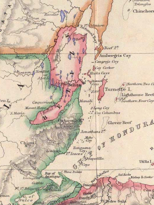
English: A map of Belize, most likely produced in the mid-1800s. Original source and author unknown. |
| Date | before 1863 (British Honduras was formally established in 1862) |
| Source | http://ambergriscaye.com/maps/ |
| Author | Unknown author |
Licensing
|
This work is in the public domain in its country of origin and other countries and areas where the copyright term is the author's life plus 100 years or fewer. | |
| This file has been identified as being free of known restrictions under copyright law, including all related and neighboring rights. | |
File history
Click on a date/time to view the file as it appeared at that time.
| Date/Time | Thumbnail | Dimensions | User | Comment | |
|---|---|---|---|---|---|
| current | 05:01, 15 December 2013 | | 525 × 700 (348 KB) | Kaldari | User created page with UploadWizard |
File usage
No pages on the English Wikipedia use this file (pages on other projects are not listed).