File:1815m4.jpg
Appearance

Size of this preview: 702 × 599 pixels. Other resolutions: 281 × 240 pixels | 562 × 480 pixels | 900 × 768 pixels | 1,199 × 1,024 pixels | 1,689 × 1,442 pixels.
Original file (1,689 × 1,442 pixels, file size: 147 KB, MIME type: image/jpeg)
File history
Click on a date/time to view the file as it appeared at that time.
| Date/Time | Thumbnail | Dimensions | User | Comment | |
|---|---|---|---|---|---|
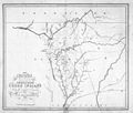
| current | 14:00, 3 March 2010 |  | 1,689 × 1,442 (147 KB) | Avaghnn | {{Information |Description={{en|1=United States Government map of Federal Road through Cherokee lands. Shows Alabama, Georgia, and Tennessee.}} |Source=http://www.libs.uga.edu/darchive/hargrett/maps/1815m4.jpg |Author=United States Government, War Departm |
File usage
The following page uses this file:
Global file usage
The following other wikis use this file:
- Usage on www.wikidata.org

