
File:1857 U.S. Coast Survey Map or Chart of St. Mary's River and Fernandina Harbor, Florida - Geographicus - StMarys-uscs-1857.jpg
Size of this preview: 764 × 599 pixels. Other resolutions: 306 × 240 pixels | 612 × 480 pixels | 979 × 768 pixels | 1,280 × 1,004 pixels | 2,560 × 2,008 pixels | 6,000 × 4,707 pixels.
Original file (6,000 × 4,707 pixels, file size: 5.18 MB, MIME type: image/jpeg)
| This is a file from the Wikimedia Commons. Information from its description page there is shown below. Commons is a freely licensed media file repository. You can help. |
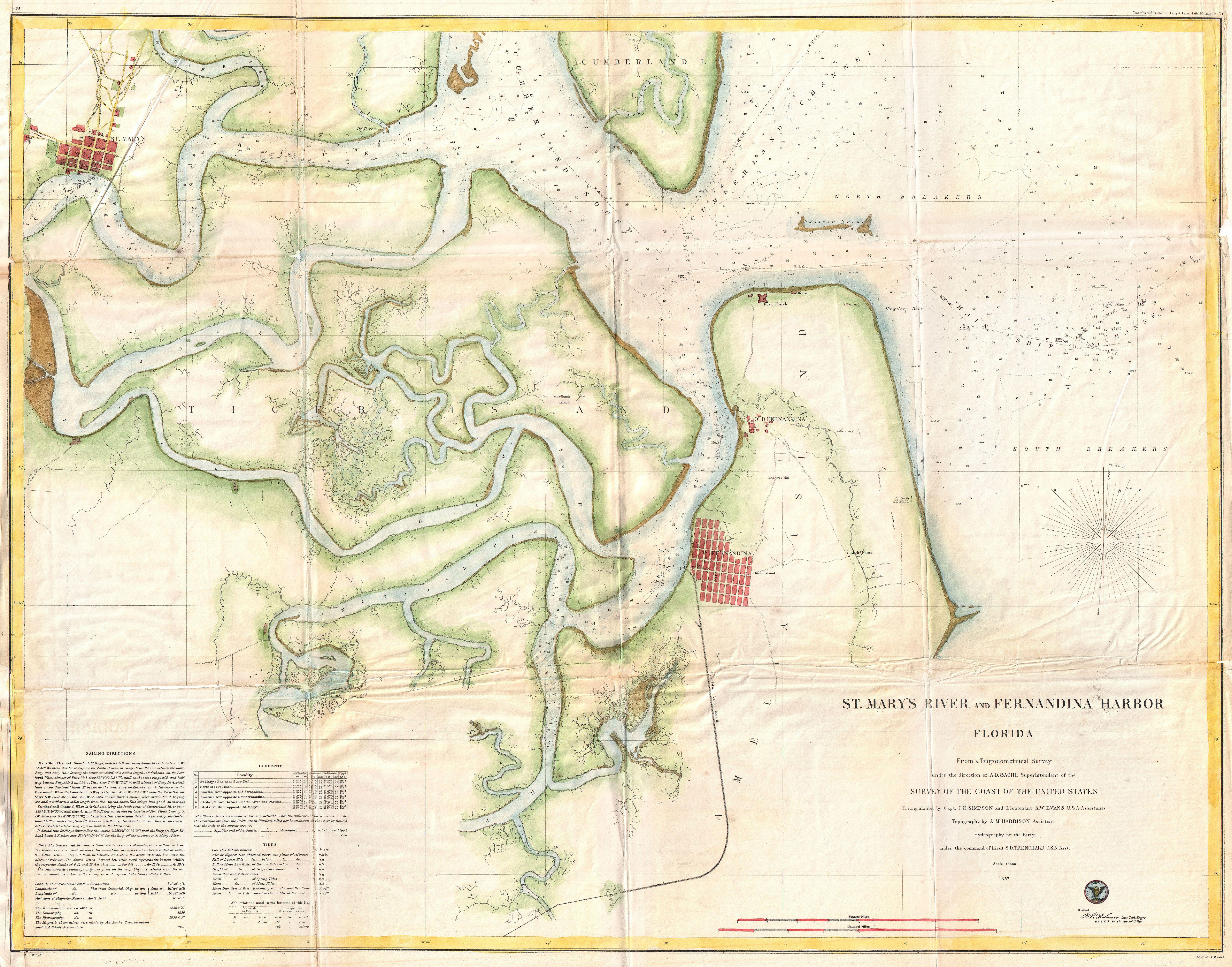
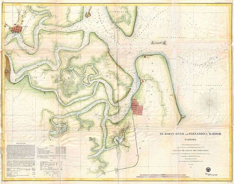
| St. Mary's River and Fernandina Harbor Florida. | |||||||||||
|---|---|---|---|---|---|---|---|---|---|---|---|
| Artist | |||||||||||
| Title |
St. Mary's River and Fernandina Harbor Florida. |
||||||||||
| Description |
English: An attractive hand colored 1857 U.S. Coast Survey sea chart or map depicting St. Mary’s River and Fernandina Harbor in Northern Florida. Details the winding course of the St. Mary River Delta from St. Mary’s to the Pacific. Shows a grid plan of the cities of St. Mary’s and Fernandina. Notes Fort Clinch on Amelia Island as well as the S. Beacon lighthouse and the Florida Rail Road. Inland regions are depicted in considerable detail, down to individual buildings. In addition to inland details, this chart contains a wealth of practical information for the mariner from oceanic depths, to harbors and navigation tips on important channels. The hand color work on this beautiful map is exceptionally well done. This map was created under the direction of A. D. Bache, Superintendent of the Survey of the Coast of the United States and one of the most influential American cartographers of the 19th century. |
||||||||||
| Date | 1857 (dated) | ||||||||||
| Dimensions | height: 25 in (63.5 cm); width: 32 in (81.2 cm) | ||||||||||
| Accession number |
Geographicus link: StMarys-uscs-1857 |
||||||||||
| Source/Photographer |
Report of the Superintendant of the U.S. Coast Survey, (1857 edition).
|
||||||||||
| Permission (Reusing this file) |
|
||||||||||

File history
Click on a date/time to view the file as it appeared at that time.
| Date/Time | Thumbnail | Dimensions | User | Comment | |
|---|---|---|---|---|---|
| current | 13:55, 22 March 2011 | | 6,000 × 4,707 (5.18 MB) | BotMultichillT | {{subst:User:Multichill/Geographicus |link=http://www.geographicus.com/P/AntiqueMap/StMarys-uscs-1857 |product_name=1857 U.S. Coast Survey Map or Chart of St. Mary's River and Fernandina Harbor, Florida |map_title=St. Mary's River and Fernandina Harbor Fl |
File usage
The following pages on the English Wikipedia use this file (pages on other projects are not listed):