
File:1857 U.S. Coast Survey Map or Chart of the Patapsco River, Chesapeake Bay and Baltimore - Geographicus - PatapscoRiver-uscs-1856.jpg
Size of this preview: 800 × 526 pixels. Other resolutions: 320 × 210 pixels | 640 × 421 pixels | 1,024 × 673 pixels | 1,280 × 841 pixels | 2,560 × 1,682 pixels | 5,000 × 3,286 pixels.
Original file (5,000 × 3,286 pixels, file size: 3.67 MB, MIME type: image/jpeg)
| This is a file from the Wikimedia Commons. Information from its description page there is shown below. Commons is a freely licensed media file repository. You can help. |
Summary
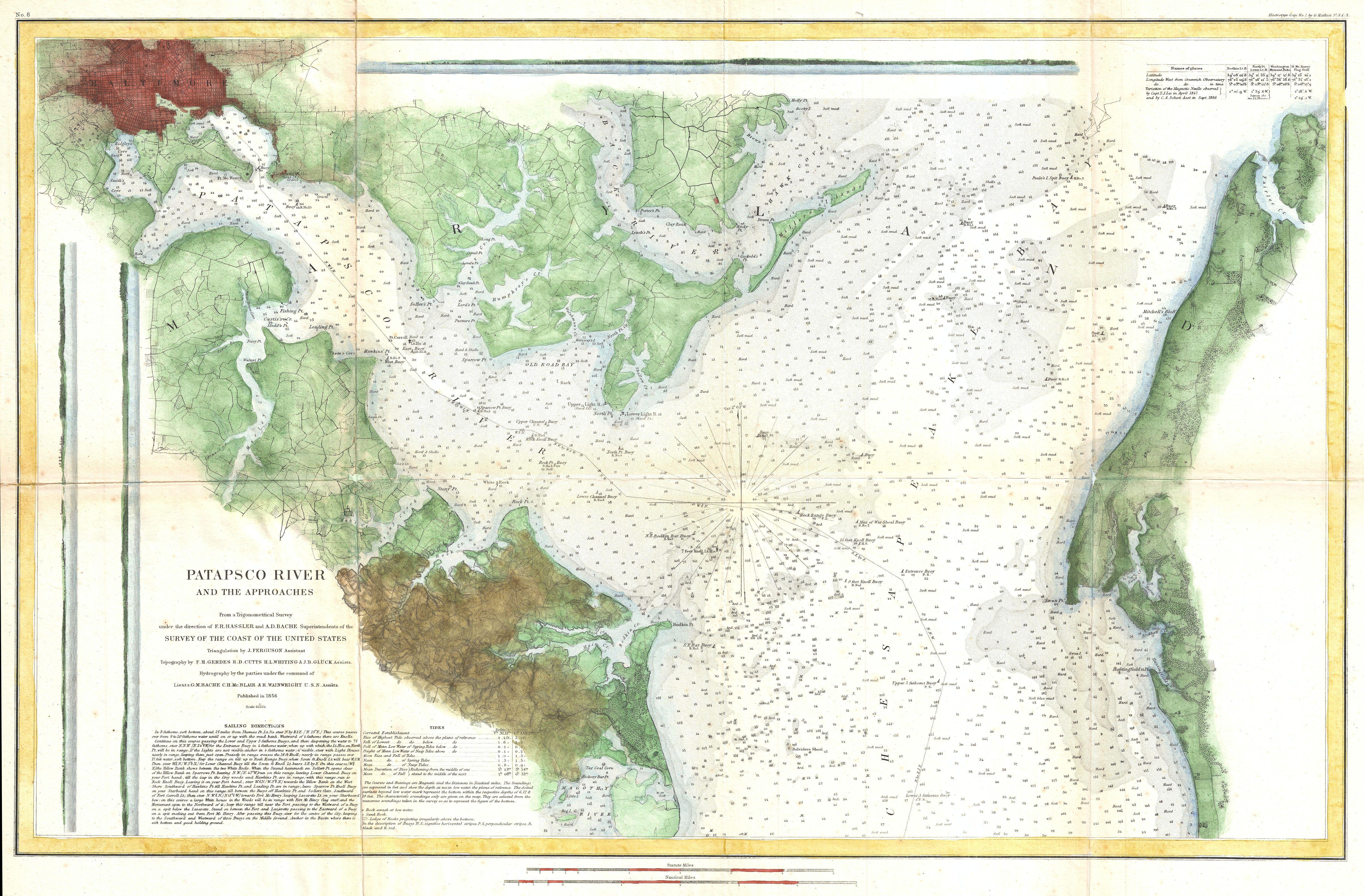
| Patapsco River and the Approaches. | ||||
|---|---|---|---|---|
| Artist | ||||
| Title |
Patapsco River and the Approaches. |
|||
| Description |
English: This is an uncommon 1856 U.S. Coast Survey Chart or Map of Patapsco River, the Chesapeake Bay, and approaches to Baltimore, Maryland. Covers from Baltimore in the northwest, eastward as far as Fairlee Creek, and southward as far as the Magothy River. Offers considerable detail throughout, but especially inland, where farms, roads, streets, and even some individual buildings are noted. Countless depth soundings throughout. Notes on tides, under sea dangers, and sailing instructions in the lower left quadrant. The Triangulation for this survey was completed by J. Ferguson. The topography is the work of F. H. Gerdes, R. D. Cutts, H. J. Whiting, and J. B Bluck. The Hydrography was accomplished by a party under the command of G. M. Bache, C. H. Mc Blair, and R. Wainwright. The construction of this chart was supervised by both A.D. Bache and F. R. Hassler, two of the most important and influential early superintendents of the U.S. Coast Survey. Published in the 1856 edition of the Superintendent's Report . |
|||
| Date | 1856 (dated) | |||
| Dimensions | height: 17.5 in (44.4 cm); width: 27.5 in (69.8 cm) | |||
| Accession number |
Geographicus link: PatapscoRiver-uscs-1856 |
|||
| Source/Photographer |
Report of the Superintendant of the U.S. Coast Survey, (1847 edition).
|
|||
| Permission (Reusing this file) |
|
|||
| Other versions | ||||

.jpg)
File history
Click on a date/time to view the file as it appeared at that time.
| Date/Time | Thumbnail | Dimensions | User | Comment | |
|---|---|---|---|---|---|
| current | 09:48, 23 March 2011 | | 5,000 × 3,286 (3.67 MB) | BotMultichillT | {{subst:User:Multichill/Geographicus |link=http://www.geographicus.com/P/AntiqueMap/PatapscoRiver-uscs-1856 |product_name=1857 U.S. Coast Survey Map or Chart of the Patapsco River, Chesapeake Bay and Baltimore |map_title=Patapsco River and the Approaches. |
File usage
No pages on the English Wikipedia use this file (pages on other projects are not listed).