
File:1870 Atlantic & Gulf.jpg

Size of this preview: 799 × 600 pixels. Other resolutions: 320 × 240 pixels | 640 × 480 pixels | 902 × 677 pixels.
Original file (902 × 677 pixels, file size: 213 KB, MIME type: image/jpeg)
| This is a file from the Wikimedia Commons. Information from its description page there is shown below. Commons is a freely licensed media file repository. You can help. |
|
This work is in the public domain in its country of origin and other countries and areas where the copyright term is the author's life plus 70 years or fewer. | |
| This file has been identified as being free of known restrictions under copyright law, including all related and neighboring rights. | |
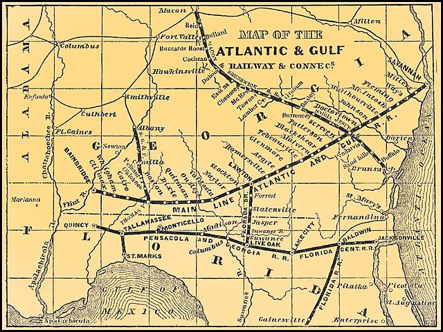
1870 map of the Atlantic and Gulf Railway, from [1] archive copy at the Wayback Machine.
File history
Click on a date/time to view the file as it appeared at that time.
| Date/Time | Thumbnail | Dimensions | User | Comment | |
|---|---|---|---|---|---|
| current | 18:42, 19 June 2005 | | 902 × 677 (213 KB) | SPUI~commonswiki | {{PD}} 1870 map of the Atlantic and Gulf Railway, from [http://www.railga.com/atgulf70map.html]. category:railroad mapscategory:Atlantic Coast Line Railroad |
File usage
The following pages on the English Wikipedia use this file (pages on other projects are not listed):