
File:1980 St. Helens ashmap.png
Size of this preview: 800 × 545 pixels. Other resolutions: 320 × 218 pixels | 640 × 436 pixels | 808 × 550 pixels.
Original file (808 × 550 pixels, file size: 11 KB, MIME type: image/png)
| This is a file from the Wikimedia Commons. Information from its description page there is shown below. Commons is a freely licensed media file repository. You can help. |
Licensing

|
File:1980 Mount st helens ash distribution.svg is a vector version of this file. It should be used in place of this PNG file.
File:1980 St. Helens ashmap.png → File:1980 Mount st helens ash distribution.svg
For more information, see Help:SVG. |
 |
This image is in the public domain in the United States because it only contains materials that originally came from the United States Geological Survey, an agency of the United States Department of the Interior. For more information, see the official USGS copyright policy.
|
File history
Click on a date/time to view the file as it appeared at that time.
| Date/Time | Thumbnail | Dimensions | User | Comment | |
|---|---|---|---|---|---|
| current | 21:00, 25 September 2008 | | 808 × 550 (11 KB) | AVRS | optipng -o7 && advpng -z4 |
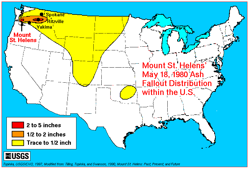
| 04:01, 30 March 2006 |  | 808 × 550 (14 KB) | Mnh | Transferred from en:Image:1980_St._Helens_ashmap.png. Map is the work of a USGS employee and thus a work of the US government. Originally uploaded by en:User:Maveric149. Image contents: Ash deposits from the 1980 eruption of Mount St. Helens we |
File usage
No pages on the English Wikipedia use this file (pages on other projects are not listed).
Global file usage
The following other wikis use this file:
- Usage on fr.wikipedia.org