
File:2006 Israel-Lebanon crisis.svg

Size of this PNG preview of this SVG file: 676 × 600 pixels. Other resolutions: 270 × 240 pixels | 541 × 480 pixels | 865 × 768 pixels | 1,154 × 1,024 pixels | 2,308 × 2,048 pixels | 818 × 726 pixels.
Original file (SVG file, nominally 818 × 726 pixels, file size: 288 KB)
| This is a file from the Wikimedia Commons. Information from its description page there is shown below. Commons is a freely licensed media file repository. You can help. |
Summary
| Description |
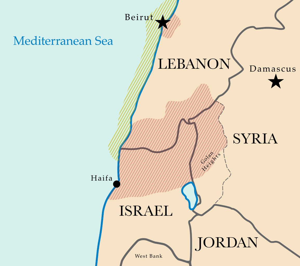
Map of Combat Regions in the 2006 Israel-Lebanon Crisis. The region of conflict is marked in red, while the Israeli naval blockade is highlighted in yellow. Based on maps from CIA World Factbook. |
| Date | 16 July 2006 (original upload date) |
| Source | No machine-readable source provided. Own work assumed (based on copyright claims). |
| Author | No machine-readable author provided. Mobius assumed (based on copyright claims). |
Licensing
| I, the copyright holder of this work, release this work into the public domain. This applies worldwide. In some countries this may not be legally possible; if so: I grant anyone the right to use this work for any purpose, without any conditions, unless such conditions are required by law. |
File history
Click on a date/time to view the file as it appeared at that time.
| Date/Time | Thumbnail | Dimensions | User | Comment | |
|---|---|---|---|---|---|
| current | 11:07, 16 July 2006 | | 818 × 726 (288 KB) | Mobius | oops, forgot West Bank..fixed shading |
| 10:58, 16 July 2006 |  | 818 × 726 (284 KB) | Mobius | Map of Combat Regions in the 2006 Israel-Lebanon Crisis. The Rregion of conflict is marked in red, while the Israeli naval blockade is highlighted in yellow. Based off of maps from CIA World Factbook. |
File usage
The following pages on the English Wikipedia use this file (pages on other projects are not listed):
Global file usage
The following other wikis use this file:
- Usage on incubator.wikimedia.org
- Usage on pt.wikinews.org
- Usage on sh.wikipedia.org
- Usage on sq.wikipedia.org