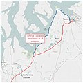
File:2017 Washington train derailment overview map.jpg
Appearance

Size of this preview: 480 × 600 pixels. Other resolutions: 192 × 240 pixels | 384 × 480 pixels | 614 × 768 pixels | 819 × 1,024 pixels | 1,638 × 2,048 pixels | 3,200 × 4,000 pixels.
Original file (3,200 × 4,000 pixels, file size: 851 KB, MIME type: image/jpeg)
File history
Click on a date/time to view the file as it appeared at that time.
| Date/Time | Thumbnail | Dimensions | User | Comment | |
|---|---|---|---|---|---|
| current | 03:12, 25 December 2017 |  | 3,200 × 4,000 (851 KB) | Dennis Bratland | add shields icons for highways |
| 01:36, 25 December 2017 |  | 3,200 × 4,000 (835 KB) | Dennis Bratland | Boundaries for JBLM, cities. Annotate land forms, add roads. | |
| 01:05, 19 December 2017 |  | 4,000 × 4,000 (992 KB) | Dennis Bratland | User created page with UploadWizard |
File usage
The following page uses this file:
Global file usage
The following other wikis use this file:
- Usage on bn.wikipedia.org
- Usage on de.wikipedia.org
- Usage on es.wikipedia.org
- Usage on nl.wikinews.org
