
File:3D locations in Google Earth.png
Size of this preview: 800 × 410 pixels. Other resolutions: 320 × 164 pixels | 640 × 328 pixels | 1,436 × 736 pixels.
Original file (1,436 × 736 pixels, file size: 51 KB, MIME type: image/png)
| This is a file from the Wikimedia Commons. Information from its description page there is shown below. Commons is a freely licensed media file repository. You can help. |
Summary
| Description |
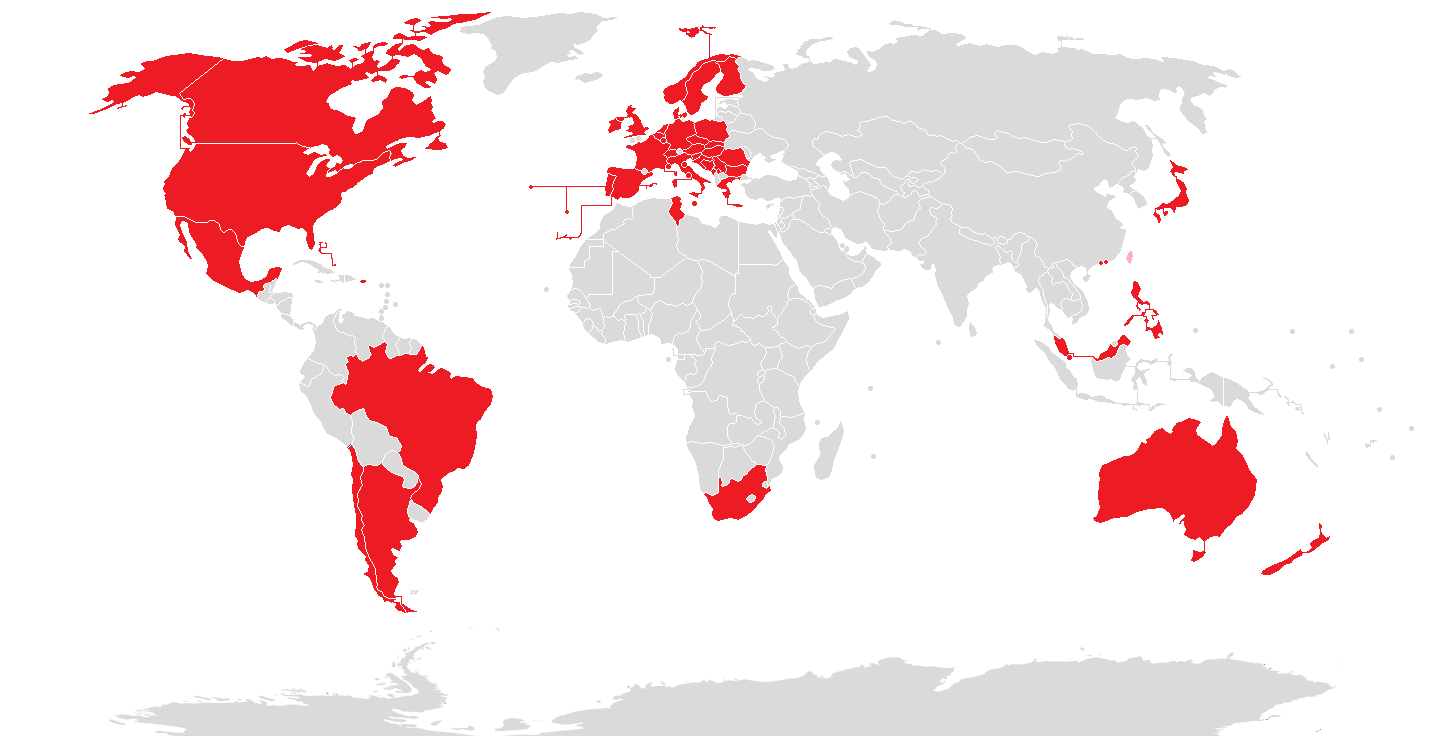
English: Countries which have regions available in Google Earth as a three dimensional model |
| Date | |
| Source | Own work |
| Author | Eugen Simion 14 |

|
File:3D locations in Google Earth.svg is a vector version of this file. It should be used in place of this PNG file when not inferior.
File:3D locations in Google Earth.png → File:3D locations in Google Earth.svg
For more information, see Help:SVG. |
 |
Licensing
I, the copyright holder of this work, hereby publish it under the following license:
| This file is made available under the Creative Commons CC0 1.0 Universal Public Domain Dedication. | |
| The person who associated a work with this deed has dedicated the work to the public domain by waiving all of their rights to the work worldwide under copyright law, including all related and neighboring rights, to the extent allowed by law. You can copy, modify, distribute and perform the work, even for commercial purposes, all without asking permission.
|
File history
Click on a date/time to view the file as it appeared at that time.
| Date/Time | Thumbnail | Dimensions | User | Comment | |
|---|---|---|---|---|---|
| current | 23:26, 1 November 2019 | | 1,436 × 736 (51 KB) | Owen313 | New 3D Maps in Serbia. Pink means countries with former 3D Maps (Taiwan). |
| 23:07, 25 February 2019 |  | 1,436 × 736 (51 KB) | Owen313 | Google just removed the 3D rendered maps in Taiwan after security concerns. | |
| 01:46, 17 February 2019 |  | 1,436 × 736 (51 KB) | Owen313 | wait. i don't think i added it in right. | |
| 01:44, 17 February 2019 |  | 1,436 × 736 (52 KB) | Owen313 | Added in Taiwan. | |
| 15:00, 3 August 2018 |  | 1,436 × 736 (76 KB) | Lejames18 | Added The Bahamas, Macau, San Marino, and Singapore. | |
| 15:23, 2 August 2018 |  | 1,436 × 736 (75 KB) | Lejames18 | Added Monaco | |
| 23:43, 1 August 2018 |  | 1,436 × 736 (75 KB) | Lejames18 | Added Slovakia | |
| 17:44, 30 July 2018 |  | 1,436 × 736 (75 KB) | Lejames18 | Added Bosnia and Herzegovina. [https://en.m.wikipedia.org/wiki/Brod,_Bosnia_and_Herzegovina Brod] | |
| 05:21, 28 January 2018 |  | 1,436 × 736 (48 KB) | Stormocean | Deleted Slovakia; added Malaysia, Tunisia, Malta, and Puerto Rico; updated in Jan 2018 | |
| 11:10, 22 January 2016 |  | 1,436 × 736 (52 KB) | Eugen Simion 14 | update |
File usage
No pages on the English Wikipedia use this file (pages on other projects are not listed).
Global file usage
The following other wikis use this file:
- Usage on es.wikipedia.org
- Usage on it.wikipedia.org
- Usage on ur.wikipedia.org
- Usage on zh.wikipedia.org