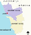
File:Administrative map of Goa.png
Appearance

Size of this preview: 373 × 599 pixels. Other resolutions: 149 × 240 pixels | 299 × 480 pixels | 808 × 1,298 pixels.
Original file (808 × 1,298 pixels, file size: 163 KB, MIME type: image/png)
File history
Click on a date/time to view the file as it appeared at that time.
| Date/Time | Thumbnail | Dimensions | User | Comment | |
|---|---|---|---|---|---|
| current | 17:27, 23 June 2014 |  | 808 × 1,298 (163 KB) | Chumwa | == {{int:filedesc}} == {{Information |Description = {{de|1=Administrative Karte von Goa mit den derzeit 12 Talukas}} {{en|1=Administrative map of Goa with the actual 12 talukas}} {{fr|1=Carte administrative de Goa avec les 12 talukas actuel}} |Source=... |
File usage
The following 12 pages use this file:
- Annexation of Goa
- Canacona taluka
- Goa
- India–Portugal relations
- List of cities in Goa by population
- List of districts of Goa
- List of talukas of Goa
- Ponda taluka
- Porvorim
- Portal:India/Picture of the week, 2006
- Portal:India/Picture of the week 48, 2006
- Portal:India/SC Summary/SP Map of the talukas (divisions) of Goa
Global file usage
The following other wikis use this file:
- Usage on ar.wikipedia.org
- Usage on as.wikipedia.org
- Usage on be.wikipedia.org
- Usage on bg.wikipedia.org
- Usage on bh.wikipedia.org
- Usage on bn.wikipedia.org
- পানাজি
- আলদোনা
- বামবোলিম
- বান্দোরা
- বেনোলিম
- কালাঙ্গুত
- কালাপুর
- কান্দোলিম
- কারাপুর
- চিকালিম
- চিম্বেল
- চিনচিনিম
- কোলভালে
- কুর্তি
- দাভোরলিম
- পুরনো গোয়া
- গুইরিম
- নাভেলিম
- পালে
- পারসেম
- পেনহা-দা-ফ্রাঙ্কা
- কুয়েনুলা
- রীস মাগোস
- সালিগাও
- সানকোল
- সানভোরদেম
- সাও হসে-দ্য-আরেয়াল
- সিওলিম
- সকরো
- ভারকা
- বিচোলিম
- কানাকোনা
- কান্কোলিম
- কারচোরেম কাকোরা
- মাপুসা
- মার্মাগাঁও
- পেরেনেম
- পোন্ডা
- কুয়েপেম
- সাঙ্গুয়েম
- সাংকেলিম
- ভাল্পোই
- টেমপ্লেট:গোয়ার-শহর-অসম্পূর্ণ
- উত্তর গোয়া জেলা
- ভারত কর্তৃক গোয়া দখল
View more global usage of this file.


