
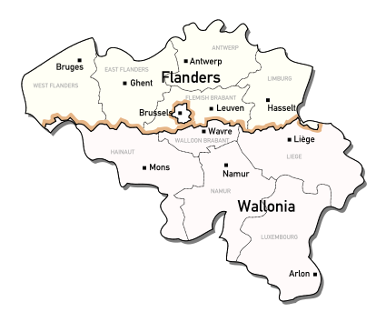
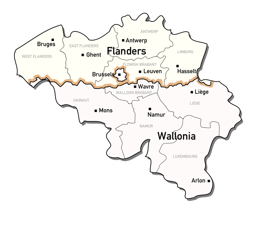
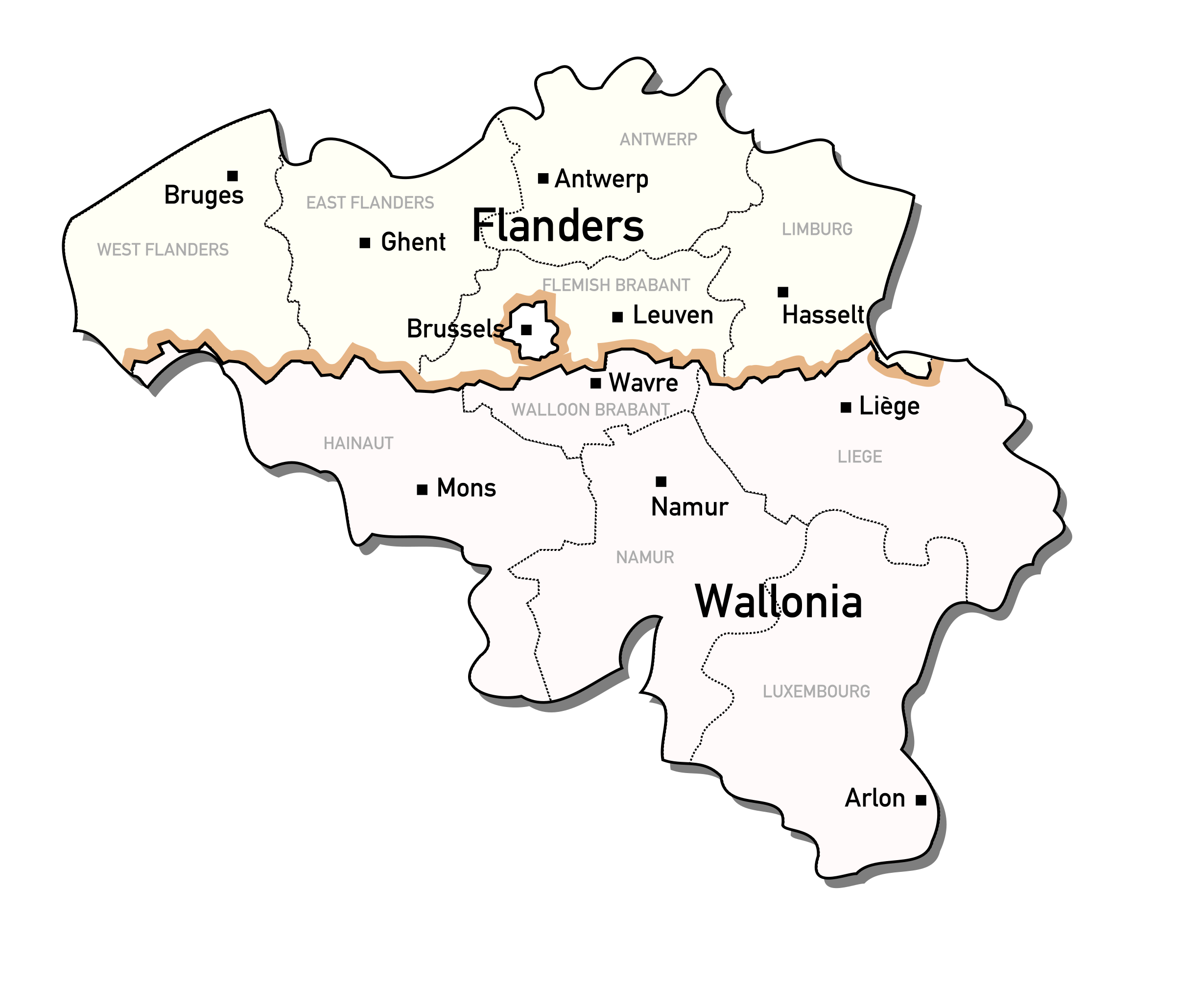
File:Administrative regions of Belgium.svg

Size of this PNG preview of this SVG file: 425 × 354 pixels. Other resolutions: 288 × 240 pixels | 576 × 480 pixels | 922 × 768 pixels | 1,229 × 1,024 pixels | 2,459 × 2,048 pixels.
Original file (SVG file, nominally 425 × 354 pixels, file size: 188 KB)
| This is a file from the Wikimedia Commons. Information from its description page there is shown below. Commons is a freely licensed media file repository. You can help. |
Summary
| Description | Map of the Administrative regions of Belgium |
| Date | |
| Source | Based on a GFDL Wikipedia image: Wikipedia:Image:350px-Belgium_RegProv_border.jpg |
| Author | Michiel Buddingh' |
Licensing

|
Permission is granted to copy, distribute and/or modify this document under the terms of the GNU Free Documentation License, Version 1.2 or any later version published by the Free Software Foundation; with no Invariant Sections, no Front-Cover Texts, and no Back-Cover Texts. A copy of the license is included in the section entitled GNU Free Documentation License. |
| This file is licensed under the Creative Commons Attribution-Share Alike 3.0 Unported license. | ||
| ||
| This licensing tag was added to this file as part of the GFDL licensing update. |
File history
Click on a date/time to view the file as it appeared at that time.
| Date/Time | Thumbnail | Dimensions | User | Comment | |
|---|---|---|---|---|---|
| current | 10:23, 16 October 2006 | | 425 × 354 (188 KB) | Michiel Buddingh'~commonswiki | {{Information |Description = Map of the Administrative regions of Belgium |Source = Based on a GFDL Wikipedia image: {{srlink|Wikipedia:Image:350px-Belgium_RegProv_border.jpg}} |Date = 2006-10-16 |Author = User:Michiel_Buddingh' |Permission = See be |
File usage
The following pages on the English Wikipedia use this file (pages on other projects are not listed):