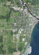
File:Aerial view of Algoma, Wisconsin 2020.png
Appearance

Size of this preview: 450 × 600 pixels. Other resolutions: 180 × 240 pixels | 360 × 480 pixels | 576 × 768 pixels | 768 × 1,024 pixels | 1,537 × 2,048 pixels | 9,399 × 12,526 pixels.
Original file (9,399 × 12,526 pixels, file size: 217.45 MB, MIME type: image/png)
File history
Click on a date/time to view the file as it appeared at that time.
| Date/Time | Thumbnail | Dimensions | User | Comment | |
|---|---|---|---|---|---|
| current | 11:52, 5 April 2022 |  | 9,399 × 12,526 (217.45 MB) | Epiphyllumlover | c:User:Rillke/bigChunkedUpload.js: {{Information | Description = {{en|Aerial view of Algoma, Wisconsin, taken on June 27, 2020]] Coordinates: *Center Latitude 44°35'38.42"N *Center Longitude 87°28'06.66"W *NW Corner Lat 44°37'39.66"N *NW Corner Long 87°30'15.60"W *NE Corner Lat 44°37'40.71"N *NE Corner Long 87°25'59.67"W *SE Corner Lat 44°33'37.14"N *SE Corner Long 87°25'57.87"W *SW Corner Lat 44°33'36.10"N *SW Corner Long 87°30'13.50"W}} | Date = 20... |
File usage
No pages on the English Wikipedia use this file (pages on other projects are not listed).


