
File:Aerial view of the eastern side of South Manitou Island in Glen Arbor Township, Leelanau County, Michigan 2020.png

Size of this preview: 442 × 600 pixels. Other resolutions: 177 × 240 pixels | 354 × 480 pixels | 566 × 768 pixels | 754 × 1,024 pixels | 1,509 × 2,048 pixels | 9,401 × 12,757 pixels.
Original file (9,401 × 12,757 pixels, file size: 246.64 MB, MIME type: image/png)
| This is a file from the Wikimedia Commons. Information from its description page there is shown below. Commons is a freely licensed media file repository. You can help. |
| Warning | The original file is very high-resolution. It might not load properly or could cause your browser to freeze when opened at full size. |
|---|
| Description |
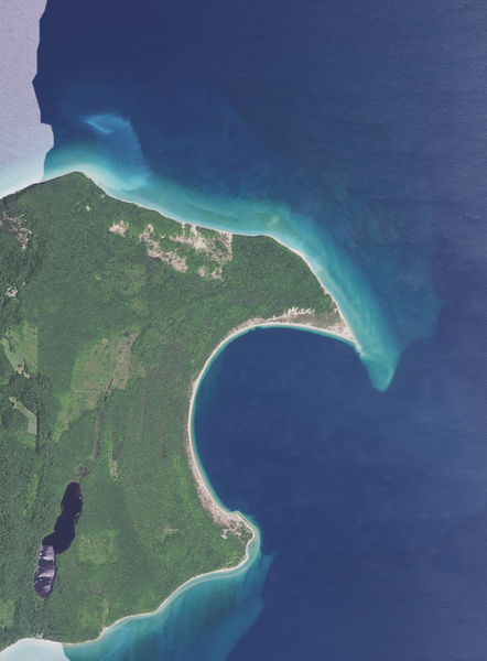
English: Aerial view of the eastern side of South Manitou Island in Glen Arbor Township, Leelanau County, taken July 28, 2020
Coordinates:
|
|||
| Date | ||||
| Source | converted to .png by Epiphyllumlover from the original .tif available as item M_4508664_SW_16_060_20200728 on EarthExplorer | |||
| Author | Aerial Photography Field Office (APFO) for NAIP, USGS; in contract with the Surdex Corporation | |||
| Permission (Reusing this file) |
|
File history
Click on a date/time to view the file as it appeared at that time.
| Date/Time | Thumbnail | Dimensions | User | Comment | |
|---|---|---|---|---|---|
| current | 00:32, 8 May 2022 | | 9,401 × 12,757 (246.64 MB) | Epiphyllumlover | c:User:Rillke/bigChunkedUpload.js: {{Information | Description = {{en|Aerial view of the western side of South Manitou Island in Glen Arbor Township, Leelanau County, taken July 28, 2020 Coordinates: *Center Latitude 45°01'53.40"N *Center Longitude 86°05'36.53"W *NW Corner Lat 45°03'58.41"N *NW Corner Long 86°07'43.52"W *NE Corner Lat 45°03'56.36"N *NE Corner Long 86°03'25.62"W *SE Corner Lat 44°59'... |
File usage
The following pages on the English Wikipedia use this file (pages on other projects are not listed):