
File:Albe planlatium.jpg
Size of this preview: 781 × 600 pixels. Other resolutions: 313 × 240 pixels | 625 × 480 pixels | 1,000 × 768 pixels | 1,280 × 983 pixels | 2,560 × 1,965 pixels | 2,734 × 2,099 pixels.
Original file (2,734 × 2,099 pixels, file size: 1.83 MB, MIME type: image/jpeg)
| This is a file from the Wikimedia Commons. Information from its description page there is shown below. Commons is a freely licensed media file repository. You can help. |
Lblblblblbl
Summary
| Description |
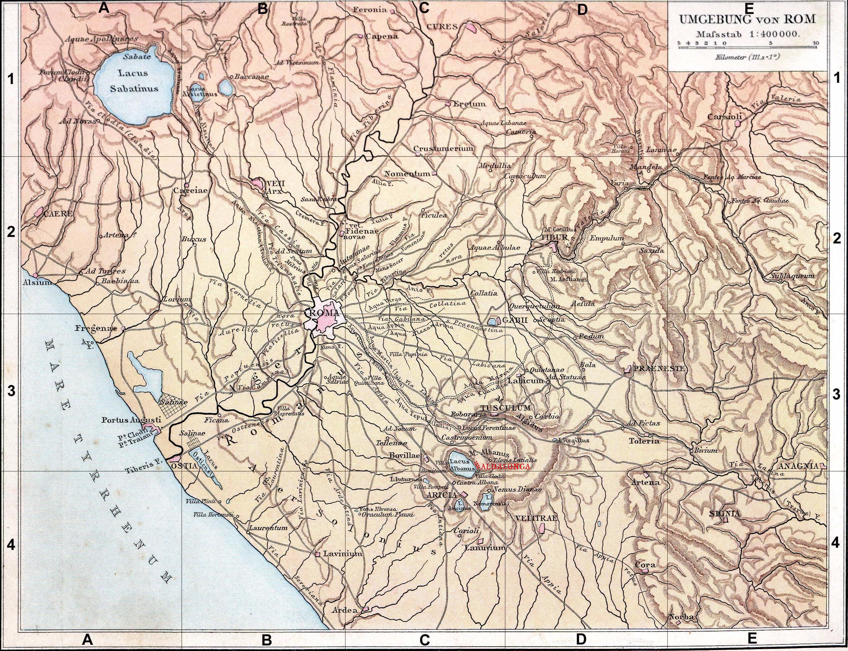
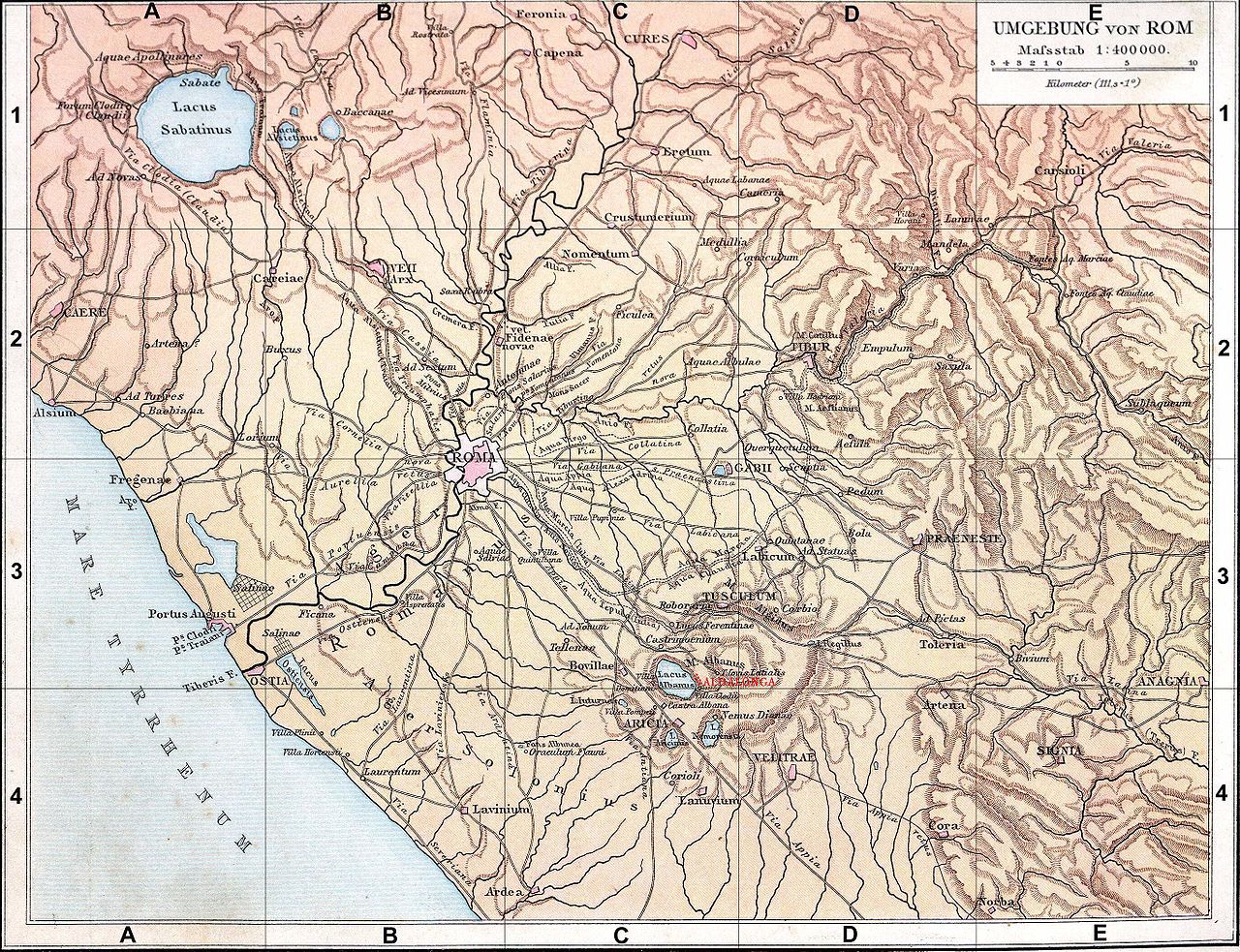
Français : Fond de carte de 1886 (G. Droysens Allgemeiner Historischer Handatlas), libre de droit (Image:Rom_Umgebung.jpg), avec Albe-la-Longue en rouge. |
| Date | / 2008 |
| Source | Fond de carte 1886 / travail personnel (own work) |
| Author | ? / Coldeel |
| Other versions | Image:Rom_Umgebung.jpg |
Licensing
| I, the copyright holder of this work, release this work into the public domain. This applies worldwide. In some countries this may not be legally possible; if so: I grant anyone the right to use this work for any purpose, without any conditions, unless such conditions are required by law. |
File history
Click on a date/time to view the file as it appeared at that time.
| Date/Time | Thumbnail | Dimensions | User | Comment | |
|---|---|---|---|---|---|
| current | 12:24, 15 June 2008 | | 2,734 × 2,099 (1.83 MB) | Coldeel | {{Information |Description={{fr|1=Fond de carte de 1886 (G. Droysens Allgemeiner Historischer Handatlas), libre de droit (Image:Rom_Umgebung.jpg), avec Albe-la-Longue en rouge.}} |Source=Fond de carte 1886 / travail personnel (own work) |Author=? / [ |
File usage
The following 2 pages use this file:
Global file usage
The following other wikis use this file:
- Usage on br.wikipedia.org
- Usage on cs.wikipedia.org
- Usage on de.wikipedia.org
- Usage on el.wikipedia.org
- Usage on es.wikipedia.org
- Usage on fi.wikipedia.org
- Usage on gl.wikipedia.org
- Usage on hu.wikipedia.org
- Usage on it.wikipedia.org
- Usage on it.wikiversity.org
- Usage on la.wikipedia.org
- Usage on nds.wikipedia.org
- Usage on nl.wikipedia.org
- Usage on oc.wikipedia.org
- Usage on pt.wikipedia.org
- Usage on ro.wikipedia.org
- Usage on ru.wikipedia.org
- Usage on sv.wikipedia.org
- Usage on www.wikidata.org