
File:Alta2012.png
Size of this preview: 500 × 599 pixels. Other resolutions: 200 × 240 pixels | 400 × 480 pixels | 641 × 768 pixels | 854 × 1,024 pixels | 1,708 × 2,048 pixels | 3,229 × 3,871 pixels.
Original file (3,229 × 3,871 pixels, file size: 824 KB, MIME type: image/png)
| This is a file from the Wikimedia Commons. Information from its description page there is shown below. Commons is a freely licensed media file repository. You can help. |
Summary
| Description |
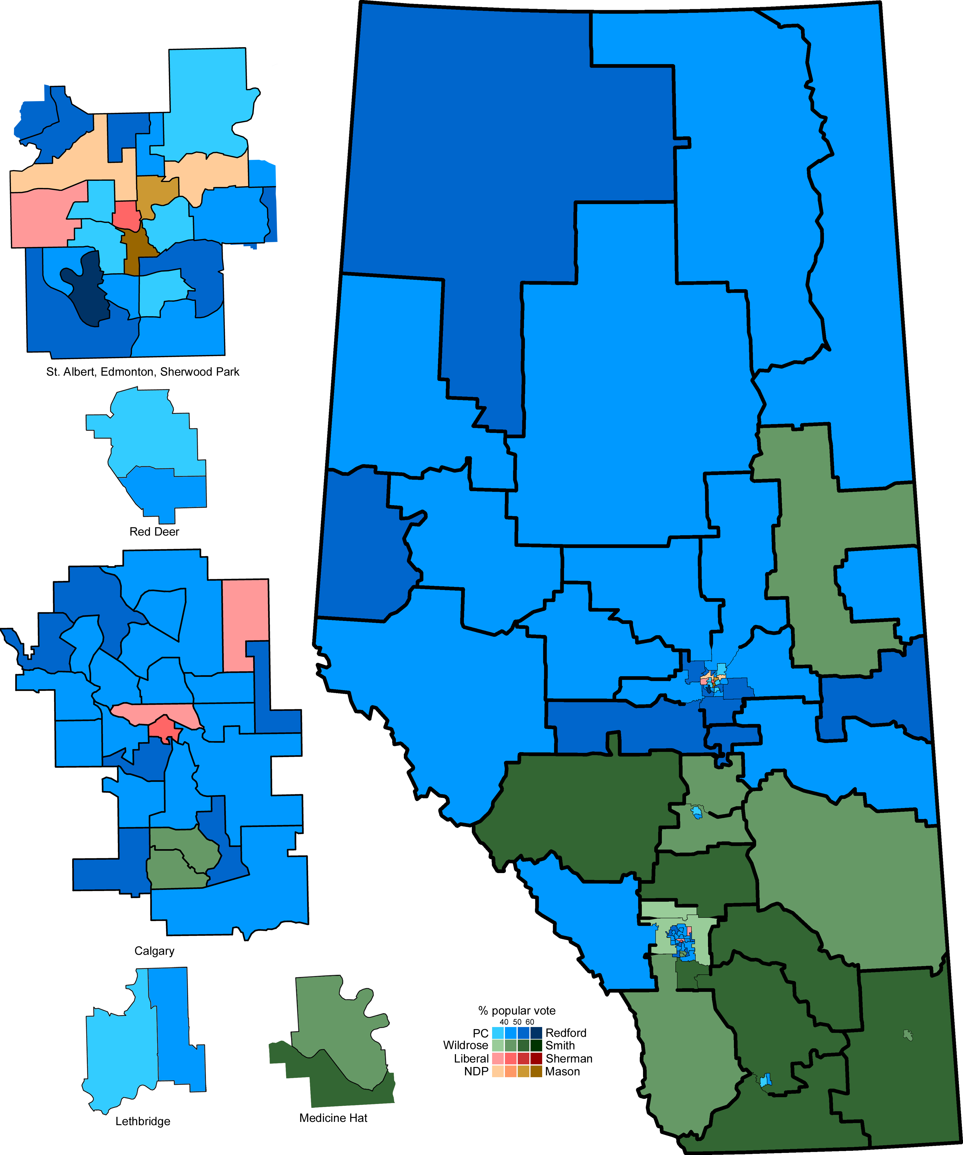
English: A map of the 87 Alberta provincial electoral districts, with the 2012 general election results. Inserts on the left are the cities of Edmonton, Red Deer, Calgary, Lethbridge, and Medicine Hat. |
| Date | |
| Source | Own work |
| Author | 117Avenue |
| Other versions |
|

| Alberta provincial election maps |
| 1905 · 1909 · 1913 · 1917 · 1921 · 1926 · 1930 · 1935 · 1940 · 1944 · 1948 · 1952 · 1955 · 1959 · 1963 · 1967 · 1971 · 1975 · 1979 · 1982 · 1986 · 1989 · 1993 · 1997 · 2001 · 2004 · 2008 · 2012 |
Licensing
| I, the copyright holder of this work, release this work into the public domain. This applies worldwide. In some countries this may not be legally possible; if so: I grant anyone the right to use this work for any purpose, without any conditions, unless such conditions are required by law. |
File history
Click on a date/time to view the file as it appeared at that time.
| Date/Time | Thumbnail | Dimensions | User | Comment | |
|---|---|---|---|---|---|
| current | 00:40, 27 April 2012 | | 3,229 × 3,871 (824 KB) | 117Avenue | correct Calgary North-West |
| 02:11, 26 April 2012 |  | 3,229 × 3,871 (825 KB) | 117Avenue | remove outliers | |
| 03:32, 25 April 2012 |  | 3,229 × 3,871 (946 KB) | 117Avenue | full results | |
| 16:11, 24 April 2012 |  | 1,088 × 1,300 (33 KB) | Noname224 | Smaller, more consistent with past maps | |
| 11:46, 24 April 2012 |  | 3,229 × 3,871 (995 KB) | 117Avenue | try to size down again | |
| 11:36, 24 April 2012 |  | 3,871 × 4,641 (1.19 MB) | 117Avenue | {{Information |Description ={{en|1=A map of the 87 Alberta provincial electoral districts, with the 2012 general election results. Inserts on the left are the cities of Edmonton, Red Deer, Calga... |
File usage
No pages on the English Wikipedia use this file (pages on other projects are not listed).
Global file usage
The following other wikis use this file:
- Usage on fr.wikipedia.org