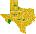
File:Arizona Democratic Presidential Primary Election Results by County, 2016.svg
Appearance

Size of this PNG preview of this SVG file: 600 × 600 pixels. Other resolutions: 240 × 240 pixels | 480 × 480 pixels | 768 × 768 pixels | 1,024 × 1,024 pixels | 2,048 × 2,048 pixels | 810 × 810 pixels.
Original file (SVG file, nominally 810 × 810 pixels, file size: 17 KB)
File history
Click on a date/time to view the file as it appeared at that time.
| Date/Time | Thumbnail | Dimensions | User | Comment | |
|---|---|---|---|---|---|
| current | 19:29, 23 May 2023 |  | 810 × 810 (17 KB) | Putitonamap98 | shapes |
| 15:31, 26 December 2022 |  | 744 × 744 (152 KB) | Putitonamap98 | shapes | |
| 20:42, 20 October 2020 |  | 277 × 323 (10 KB) | Coffee | No, it isn't, please review File:Arizona_Locator_Map.PNG | |
| 03:50, 20 October 2020 |  | 277 × 323 (9 KB) | TylerKutschbach | This is what we use for the Arizona map results | |
| 15:54, 19 October 2020 |  | 277 × 323 (10 KB) | Coffee | Fixing rotation to actually match the longitudes and latitudes of the state. The prior rotation is a confusion created by looking at a globe from the center of the United States, and is simply inaccurate. | |
| 20:02, 23 March 2016 |  | 277 × 323 (9 KB) | Supernino | updated with results | |
| 04:15, 2 February 2016 |  | 277 × 323 (9 KB) | Oganesson007 | User created page with UploadWizard |
File usage
No pages on the English Wikipedia use this file (pages on other projects are not listed).
Global file usage
The following other wikis use this file:
- Usage on it.wikipedia.org


