
File:Aru North txu-oclc-6558822-sb53-2.jpg

Size of this preview: 541 × 600 pixels. Other resolutions: 216 × 240 pixels | 433 × 480 pixels | 693 × 768 pixels | 923 × 1,024 pixels | 1,847 × 2,048 pixels | 4,326 × 4,797 pixels.
Original file (4,326 × 4,797 pixels, file size: 3.34 MB, MIME type: image/jpeg)
| This is a file from the Wikimedia Commons. Information from its description page there is shown below. Commons is a freely licensed media file repository. You can help. |
Summary
| Description |
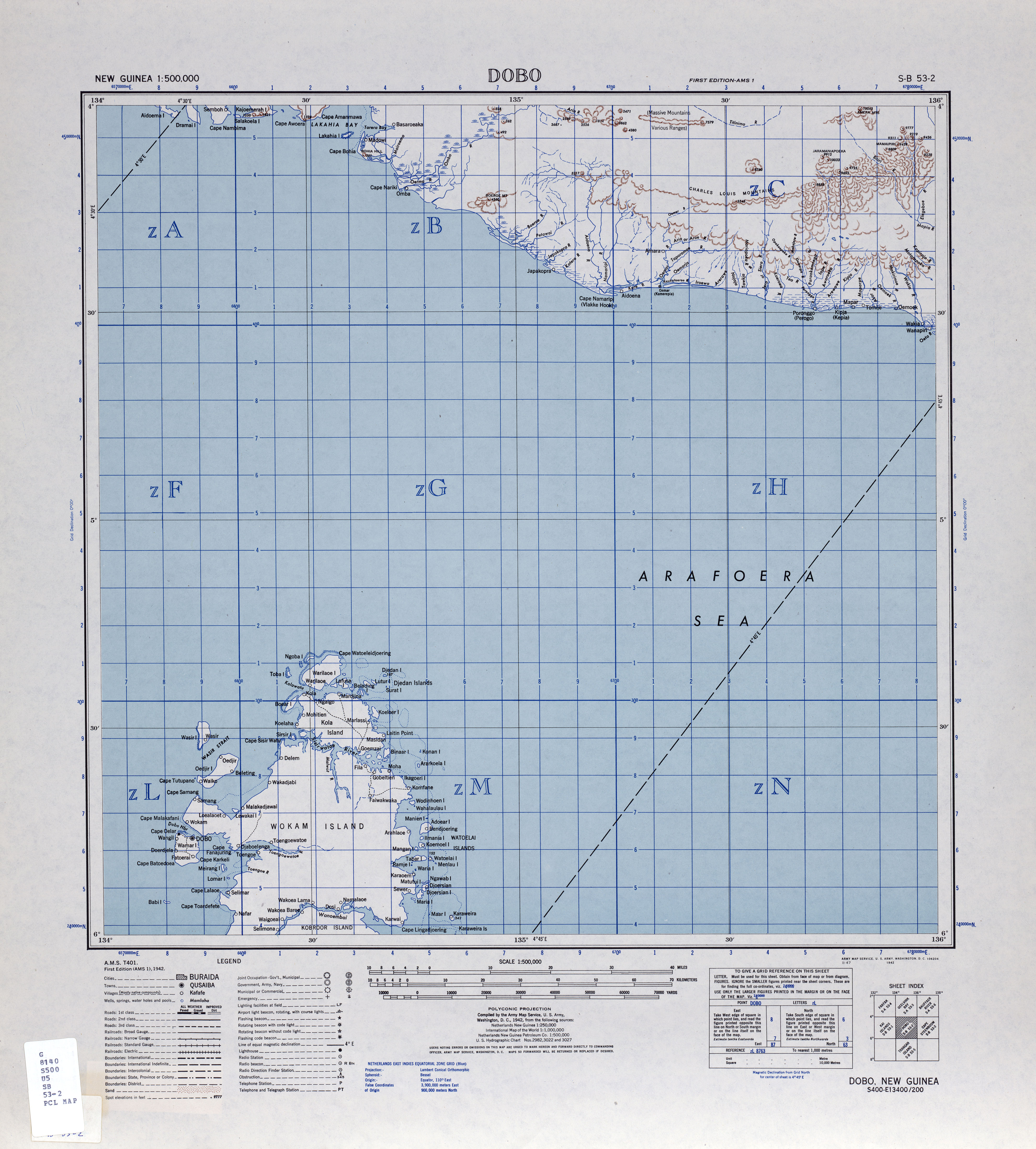
English: map of northern Aru Islands, Indonesia |
| Date | |
| Source | http://www.lib.utexas.edu/maps/ams/new_guinea_500k/txu-oclc-6558822-sb53-2.jpg |
| Author | Army Map Service, Corps of Engineers, U.S. Army |
Licensing
This file is a work of a U.S. Army soldier or employee, taken or made as part of that person's official duties. As a work of the U.S. federal government, it is in the public domain in the United States.
|
 |
File history
Click on a date/time to view the file as it appeared at that time.
| Date/Time | Thumbnail | Dimensions | User | Comment | |
|---|---|---|---|---|---|
| current | 18:01, 16 March 2010 | | 4,326 × 4,797 (3.34 MB) | Ratzer | {{Information |Description={{en|1=map of northern Aru Islands, Indonesia}} |Source=http://www.lib.utexas.edu/maps/ams/new_guinea_500k/txu-oclc-6558822-sb53-2.jpg |Author=Army Map Service, Corps of Engineers, U.S. Army |Date=1942 |Permission= |other_versio |
File usage
No pages on the English Wikipedia use this file (pages on other projects are not listed).
Global file usage
The following other wikis use this file:
- Usage on nl.wikipedia.org