
File:Austria-Hungary post-division, William Shepherd 1926 atlas.jpg

Size of this preview: 784 × 599 pixels. Other resolutions: 314 × 240 pixels | 628 × 480 pixels | 1,005 × 768 pixels | 1,280 × 979 pixels | 1,525 × 1,166 pixels.
Original file (1,525 × 1,166 pixels, file size: 626 KB, MIME type: image/jpeg)
| This is a file from the Wikimedia Commons. Information from its description page there is shown below. Commons is a freely licensed media file repository. You can help. |
Summary
| Description |
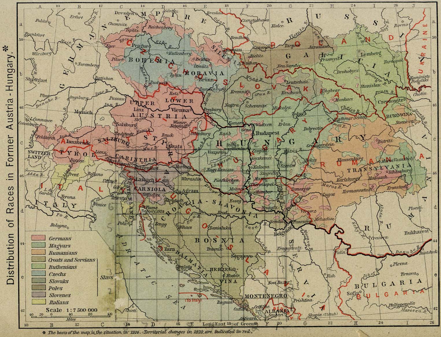
English: Map of distribution of races (by language) of Austria-Hungary with the lines marking the divisions that created the new central and eastern european countries after World War I. |
||||||||||||||||||||||
| Date | |||||||||||||||||||||||
| Source | "Historical Atlas" by William R. Shepherd, New York, Henry Holt and Company, 1926 edition via the Perry-Castañeda Library Map Collection at the University of Texas at Austin. | ||||||||||||||||||||||
| Author |
|
||||||||||||||||||||||
| Permission (Reusing this file) |
I searched copyright renewals in 1953 and 1954 and found nothing which matched under William Shepherd or Historical Atlas. | ||||||||||||||||||||||
Licensing
|
This is a faithful photographic reproduction of a two-dimensional, public domain work of art. The work of art itself is in the public domain in its source country for the following reason:
It is also in the public domain in the United States for the following reason:
The official position taken by the Wikimedia Foundation is that "faithful reproductions of two-dimensional public domain works of art are public domain".
This photographic reproduction is therefore also considered to be in the public domain in the United States. In other jurisdictions, re-use of this content may be restricted; see Reuse of PD-Art photographs for details.
| |||||||

Original upload log
The original description page was here. All following user names refer to en.wikipedia.
| Date/Time | Dimensions | User | Comment |
|---|---|---|---|
| 2008-05-27 05:12 | 1525×1166× (641355 bytes) | MaGioZal | Map of distribution of races (by language) of [[Austria-Hungary]] with the lines marking the divisions that created the new central and eastern european countries after [[World War I]]. The [http://www.lib.utexas.edu/maps/historical/shepherd/austria_hun |
File history
Click on a date/time to view the file as it appeared at that time.
| Date/Time | Thumbnail | Dimensions | User | Comment | |
|---|---|---|---|---|---|
| current | 15:57, 28 February 2017 | | 1,525 × 1,166 (626 KB) | Ранко Николић | Transferred from en.wikipedia |
File usage
No pages on the English Wikipedia use this file (pages on other projects are not listed).