
File:BS A391.png

Size of this preview: 511 × 600 pixels. Other resolutions: 204 × 240 pixels | 409 × 480 pixels | 654 × 768 pixels | 872 × 1,024 pixels | 1,404 × 1,648 pixels.
Original file (1,404 × 1,648 pixels, file size: 269 KB, MIME type: image/png)
| This is a file from the Wikimedia Commons. Information from its description page there is shown below. Commons is a freely licensed media file repository. You can help. |
Summary
| Description |
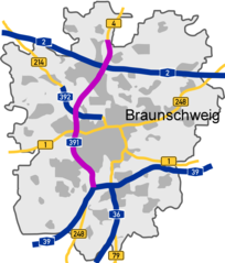
Deutsch: Lage der A391 in Braunschweig |
| Date | |
| Source | Karte selbst erstellt. Originally from de.wikipedia; description page is/was here. |
| Author | Zoidy at German Wikipedia |
Licensing
| This work has been released into the public domain by its author, Zoidy at German Wikipedia. This applies worldwide. In some countries this may not be legally possible; if so: Zoidy grants anyone the right to use this work for any purpose, without any conditions, unless such conditions are required by law. |
Original upload log
(All user names refer to de.wikipedia)
- 2006-07-21 08:35 Zoidy 1404×1648×8 (266726 bytes) * Bildbeschreibung: Lage der A391 in Braunschweig * Fotograf/Zeichner: Karte selbst erstellt * Datum: 20. Juli 2006
File history
Click on a date/time to view the file as it appeared at that time.
| Date/Time | Thumbnail | Dimensions | User | Comment | |
|---|---|---|---|---|---|
| current | 11:15, 30 December 2019 | | 1,404 × 1,648 (269 KB) | WikiDD | Changed A395 to A36 |
| 09:21, 9 February 2018 |  | 1,404 × 1,648 (269 KB) | WikiDD | Extended northern end according to current situation | |
| 14:44, 6 March 2007 |  | 1,404 × 1,648 (260 KB) | Siebrand | {{Information |Description={{de|Lage der A391 in Braunschweig}} |Source=Karte selbst erstellt. Originally from [http://de.wikipedia.org de.wikipedia]; description page is/was [http://de.wikipedia.org/w/index.php?title=Image%3ABS_A391.png here]. |Date=20. |
File usage
The following page uses this file:
Global file usage
The following other wikis use this file:
- Usage on de.wikipedia.org
- Usage on fr.wikipedia.org
- Usage on hu.wikipedia.org
- Usage on it.wikipedia.org
- Usage on nds.wikipedia.org
- Usage on nl.wikipedia.org
- Usage on no.wikipedia.org
- Usage on pl.wikipedia.org
- Usage on sk.wikipedia.org
- Usage on www.wikidata.org