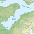
File:Baie des Ha! Ha!.svg
Appearance

Size of this PNG preview of this SVG file: 600 × 600 pixels. Other resolutions: 240 × 240 pixels | 480 × 480 pixels | 768 × 768 pixels | 1,024 × 1,024 pixels | 2,048 × 2,048 pixels | 2,000 × 2,000 pixels.
Original file (SVG file, nominally 2,000 × 2,000 pixels, file size: 2.01 MB)
File history
Click on a date/time to view the file as it appeared at that time.
| Date/Time | Thumbnail | Dimensions | User | Comment | |
|---|---|---|---|---|---|
| current | 13:47, 28 April 2008 |  | 2,000 × 2,000 (2.01 MB) | Adqproductions | == Description == {{Information |Description=Carte topographique de la Baie des Ha! Ha! |Source=travail personnel Data sources: * Background map: data from [http://atlas.nrcan.gc.ca/site/francais/maps/topo/map (public domain){{clr}} |Date= |Author= J.-P. |
| 01:06, 28 April 2008 |  | 2,000 × 2,000 (50 KB) | Adqproductions | {{Information |Description= |Source= |Date= |Author= |Permission= |other_versions= }} | |
| 01:02, 28 April 2008 |  | 2,000 × 2,000 (47 KB) | Adqproductions | {{Information |Description= |Source= |Date= |Author= |Permission= |other_versions= }} | |
| 00:59, 28 April 2008 |  | 2,000 × 2,000 (47 KB) | Adqproductions | {{Information |Description= |Source= |Date= |Author= |Permission= |other_versions= }} | |
| 00:56, 28 April 2008 |  | 2,000 × 2,000 (53 KB) | Adqproductions | == Description == == Description == {{Information |Description=Carte topographique de la Baie des Ha! Ha! |Source=travail personnel Data sources: * Background map: data from [http://atlas.nrcan.gc.ca/site/francais/maps/topo/map (public domain){{clr}} |Dat |
File usage
The following page uses this file:
Global file usage
The following other wikis use this file:
- Usage on fr.wikipedia.org
- Usage on pl.wikipedia.org

