
File:Barzan.jpg
Size of this preview: 800 × 473 pixels. Other resolutions: 320 × 189 pixels | 640 × 379 pixels | 1,024 × 606 pixels | 1,481 × 876 pixels.
Original file (1,481 × 876 pixels, file size: 244 KB, MIME type: image/jpeg)
| This is a file from the Wikimedia Commons. Information from its description page there is shown below. Commons is a freely licensed media file repository. You can help. |
Summary
| Description |
|
| Source | http://archaero.com/Arch%E9ologie-a%E9rienne.htm |
| Author | Jacques DASSIÉ |
| Permission (Reusing this file) |
coordonnées google earth google maps Latittude 45°32'7.70"N longitude 0°52'39.15"O
Licensing
I, the copyright holder of this work, hereby publish it under the following licenses:

|
Permission is granted to copy, distribute and/or modify this document under the terms of the GNU Free Documentation License, Version 1.2 or any later version published by the Free Software Foundation; with no Invariant Sections, no Front-Cover Texts, and no Back-Cover Texts. A copy of the license is included in the section entitled GNU Free Documentation License. |
| This file is licensed under the Creative Commons Attribution-Share Alike 3.0 Unported license. | ||
| ||
| This licensing tag was added to this file as part of the GFDL licensing update. |
This file is licensed under the Creative Commons Attribution 2.5 Generic license.
- You are free:
- to share – to copy, distribute and transmit the work
- to remix – to adapt the work
- Under the following conditions:
- attribution – You must give appropriate credit, provide a link to the license, and indicate if changes were made. You may do so in any reasonable manner, but not in any way that suggests the licensor endorses you or your use.
You may select the license of your choice.
File history
Click on a date/time to view the file as it appeared at that time.
| Date/Time | Thumbnail | Dimensions | User | Comment | |
|---|---|---|---|---|---|
| current | 11:10, 27 March 2023 | | 1,481 × 876 (244 KB) | ArkéoTopia | Cropped 10 % vertically using CropTool with precise mode. |
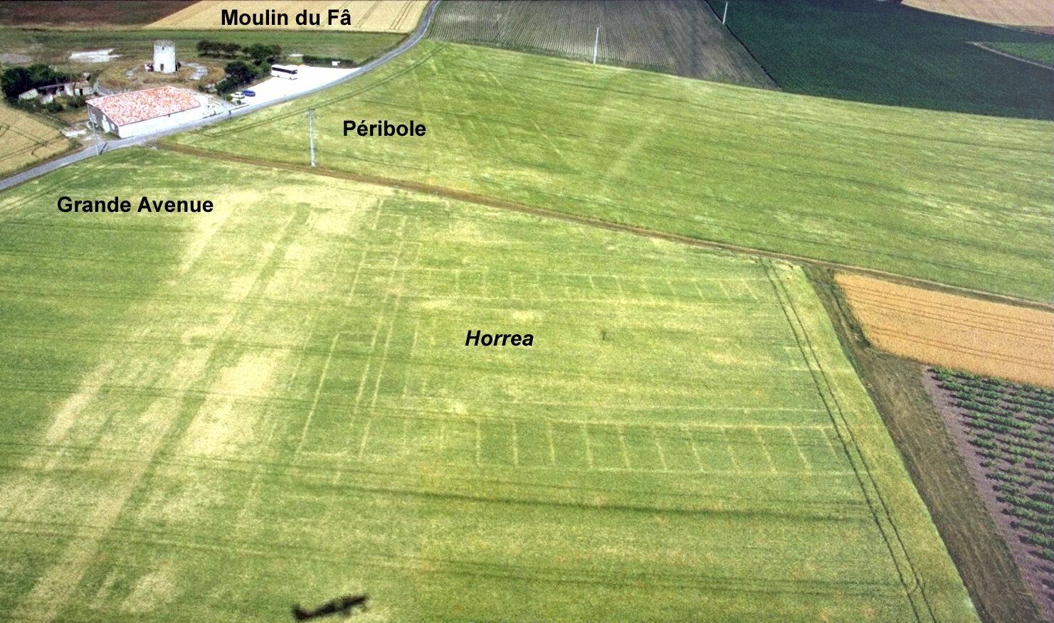
| 17:19, 17 January 2007 |  | 1,481 × 976 (300 KB) | 120 | {{Information |Description=photo aérienne de BARZAN (17) Moulin du Fâ: La grande avenue et les horrea. Les traces de la ville gallo-romaine de Novioregum. On distingue à gauche la Grande Avenue, bordée de boutiques. Au centre, les horrea, entrepôts d |
File usage
The following pages on the English Wikipedia use this file (pages on other projects are not listed):
Global file usage
The following other wikis use this file:
- Usage on cs.wikipedia.org
- Usage on de.wikipedia.org
- Usage on fr.wikipedia.org
- Usage on it.wikipedia.org
- Usage on nds.wikipedia.org
- Usage on rm.wikipedia.org
- Usage on tr.wikipedia.org