
File:Bayou des allemands 2003.jpg

Size of this preview: 800 × 507 pixels. Other resolutions: 320 × 203 pixels | 640 × 406 pixels | 1,024 × 649 pixels | 1,500 × 951 pixels.
Original file (1,500 × 951 pixels, file size: 428 KB, MIME type: image/jpeg)
| This is a file from the Wikimedia Commons. Information from its description page there is shown below. Commons is a freely licensed media file repository. You can help. |
| Description |
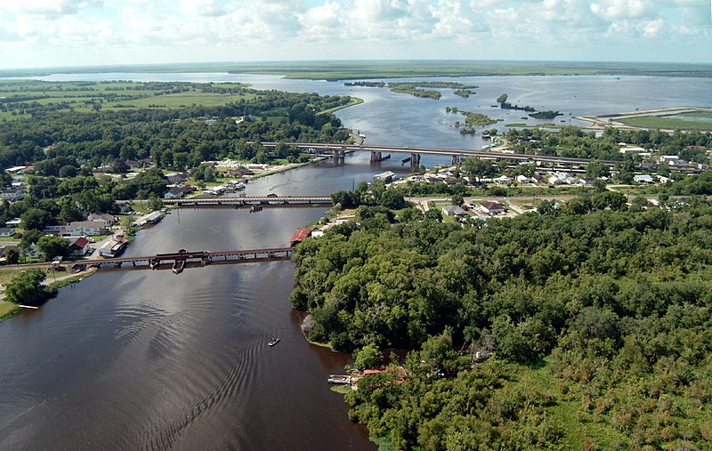
English: Bayou des Allemands and the town of Des Allemands, Louisiana, USA. The bayou empties into Dufrene Ponds (right, top) and Petit Lac Des Allemands (left, top). The bayou is the boundary between St. Charles Parish (left) and Lafourche Parish (right). The three bridges crossing the bayou are (closest to farthest): A railroad bridge, Louisiana State Route 631, and U.S. Route 90. View is to the south. |
|||
| Date | ||||
| Source |
U.S. Army Corps of Engineers Digital Visual Library Image page Image description page Digital Visual Library home page |
|||
| Author | Lane Lefort, U.S. Army Corps of Engineers | |||
| Permission (Reusing this file) |
|
|||
| Other versions | en:Image:Bayou des allemands 2003.jpg | |||
| Location | Des Allemands, Louisiana, USA |
| Camera location | | View this and other nearby images on: OpenStreetMap |
|---|
File history
Click on a date/time to view the file as it appeared at that time.
| Date/Time | Thumbnail | Dimensions | User | Comment | |
|---|---|---|---|---|---|
| current | 22:21, 7 April 2007 | | 1,500 × 951 (428 KB) | DanMS | {{Information | Description = {{en|Bayou des Allemands and the town of Des Allemands, Louisiana, USA. The bayou empties into Dufrene Ponds (right, top) and Petit Lac Des Allemands (left, top). The bayou is the boundary between St. Charles Parish (left) |
File usage
The following pages on the English Wikipedia use this file (pages on other projects are not listed):
Global file usage
The following other wikis use this file:
- Usage on fr.wikipedia.org