
File:Bazinul hidrografic al Raului Latorita, Romania.jpg

Size of this preview: 800 × 570 pixels. Other resolutions: 320 × 228 pixels | 640 × 456 pixels | 1,024 × 730 pixels | 1,280 × 913 pixels | 2,111 × 1,505 pixels.
Original file (2,111 × 1,505 pixels, file size: 1.45 MB, MIME type: image/jpeg)
| This is a file from the Wikimedia Commons. Information from its description page there is shown below. Commons is a freely licensed media file repository. You can help. |
Summary
| Description |
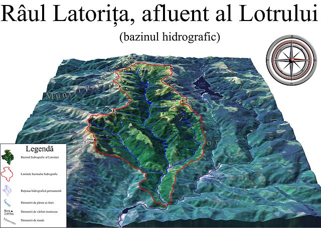
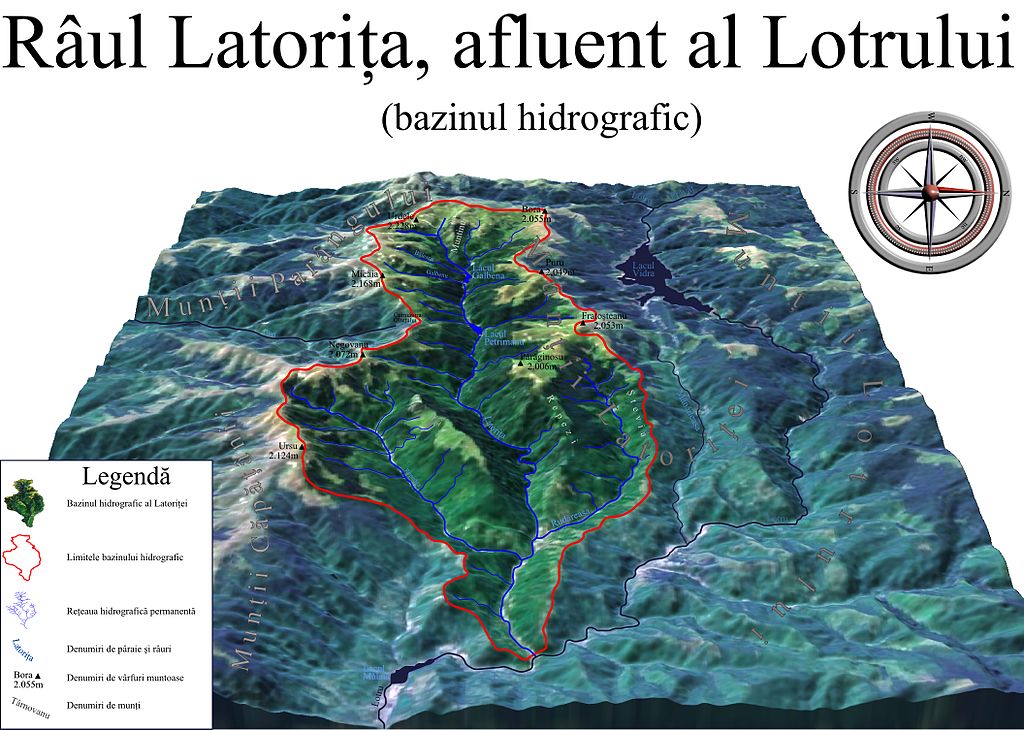
Română: Bazinul hidrografic al Râului Latorița, Romania. Selectați alte bazine hidrografice adiacente ale Defileului Oltului, menționate pe hartă în mod senzitiv cu chenare de note informative. Magyar: a Latorca folyó vízgyűjtő területének 3D ábrázolása |
| Date | |
| Source |
|
| Author | Asybaris01 |
| Other versions |
|


Clickable map of the (ro:Defileul Oltului)/(en:Defile Olt) drainage basin

Licensing
| This image is in the public domain because it is a screenshot from NASA’s globe software World Wind using a public domain layer, such as Blue Marble, MODIS, Landsat, SRTM, USGS or GLOBE.
|
 |
File history
Click on a date/time to view the file as it appeared at that time.
| Date/Time | Thumbnail | Dimensions | User | Comment | |
|---|---|---|---|---|---|
| current | 17:03, 23 October 2011 | | 2,111 × 1,505 (1.45 MB) | Asybaris01 | final |
| 17:00, 23 October 2011 |  | 2,111 × 1,505 (1.44 MB) | Asybaris01 | contrast texte | |
| 11:43, 22 October 2011 |  | 2,111 × 1,505 (1.44 MB) | Asybaris01 | contrast | |
| 10:29, 22 October 2011 |  | 2,110 × 1,505 (1.26 MB) | Asybaris01 | {{Information |Description ={{ro|1=Bazinul hidrografic al Raului Latorita, Romania.}} |Source =Topographic data SRTM from NASA and World Imagery - NASA World Wind & 3Dem & Inkscape |Author =Asybaris01 |Date |
File usage
The following pages on the English Wikipedia use this file (pages on other projects are not listed):
Global file usage
The following other wikis use this file:
- Usage on hr.wikipedia.org
- Usage on ro.wikipedia.org