File:BelgiumGeography.png
Appearance
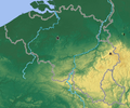
BelgiumGeography.png (330 × 275 pixels, file size: 148 KB, MIME type: image/png)
File history
Click on a date/time to view the file as it appeared at that time.
| Date/Time | Thumbnail | Dimensions | User | Comment | |
|---|---|---|---|---|---|
| current | 16:31, 19 October 2008 |  | 330 × 275 (148 KB) | Knoppen~commonswiki | {{Information |Description= |Source= |Date= |Author= |Permission= |other_versions= }} |
| 16:23, 19 October 2008 |  | 768 × 640 (900 KB) | Knoppen~commonswiki | {{Information |Description={{en|Relief map of Belgium (base map)}} {{fr|Relief de la Belgique (carte de base) }} |Source=*Image:Belgium_relief.png *Image:Be-map.png |Date=2008-10-19 16:15 (UTC) |Author=*derivative work: ~~~~-- |Permission=see |
File usage
The following page uses this file:
Global file usage
The following other wikis use this file:
- Usage on de.wikipedia.org
- Usage on de.wikibooks.org
- Usage on it.wikipedia.org
- Usage on pl.wikipedia.org
- Usage on pt.wikipedia.org
- Subdivisões da Bélgica
- Geografia da Bélgica
- Comuna belga
- Fronteira Bélgica–França
- Fronteira Bélgica–Países Baixos
- Fronteira Bélgica–Luxemburgo
- Fronteira Alemanha–Bélgica
- Lista de municípios da Bélgica por população
- Pontos extremos da Bélgica
- NUTS da Bélgica
- Predefinição:Geografia da Bélgica
- Relevo da Bélgica
- Hidrografia da Bélgica
- Clima da Bélgica
- Vegetação da Bélgica


