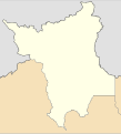
File:Brazil Roraima location map.svg
Appearance

Size of this PNG preview of this SVG file: 544 × 599 pixels. Other resolutions: 218 × 240 pixels | 436 × 480 pixels | 698 × 768 pixels | 930 × 1,024 pixels | 1,860 × 2,048 pixels | 624 × 687 pixels.
Original file (SVG file, nominally 624 × 687 pixels, file size: 228 KB)
File history
Click on a date/time to view the file as it appeared at that time.
| Date/Time | Thumbnail | Dimensions | User | Comment | |
|---|---|---|---|---|---|
| current | 20:30, 20 January 2019 |  | 624 × 687 (228 KB) | Milenioscuro | Does not match with the color conventions |
| 22:54, 19 January 2019 |  | 501 × 553 (234 KB) | Allice Hunter | Melhora nos gráficos | |
| 01:13, 14 August 2011 |  | 624 × 687 (228 KB) | Milenioscuro | {{Information |Description=Location map of Roraima state |Source=*File:Roraima_MesoMicroMunicip.svg |Date=2011-08-14 01:12 (UTC) |Author=*File:Roraima_MesoMicroMunicip.svg: Raphael Lorenzeto de Abreu *derivative work: ~~~ |Permission= |other_v |
File usage
The following 13 pages use this file:
- 2014 Roraima gubernatorial election
- 2023 Campeonato Roraimense
- Anauá National Forest
- Boa Vista Air Force Base
- Boa Vista International Airport
- Cantá
- Iracema, Roraima
- Santa Maria do Boiaçu
- São João da Baliza
- Takutu River
- Waimiri Atroari Indigenous Territory
- Module:Location map/data/Roraima
- Module:Location map/data/Roraima/doc
Global file usage
The following other wikis use this file:
- Usage on de.wikipedia.org
- Usage on es.wikipedia.org
- Usage on fr.wikipedia.org
- Usage on he.wikipedia.org
- Usage on ia.wikipedia.org
- Usage on it.wikipedia.org
- Usage on kbd.wikipedia.org
- Usage on os.wikipedia.org
- Usage on pl.wikipedia.org
View more global usage of this file.

