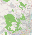
File:Buda Hills OSM map 2.png
Appearance

Size of this preview: 546 × 599 pixels. Other resolutions: 219 × 240 pixels | 437 × 480 pixels | 975 × 1,070 pixels.
Original file (975 × 1,070 pixels, file size: 787 KB, MIME type: image/png)
File history
Click on a date/time to view the file as it appeared at that time.
| Date/Time | Thumbnail | Dimensions | User | Comment | |
|---|---|---|---|---|---|
| current | 14:43, 28 October 2011 |  | 975 × 1,070 (787 KB) | Antissimo |
File usage
The following page uses this file:
Global file usage
The following other wikis use this file:
- Usage on de.wikipedia.org
- Usage on eo.wikipedia.org
- Usage on hu.wikipedia.org
- Sas-hegy
- Várhegy (Buda)
- Csúcs-hegy (Budapest)
- Nagy-Kopasz (Budai-hegység)
- Hármashatár-hegy
- Virágvölgy vasútállomás
- Kecske-hegy
- Orbán-hegy
- Budaörsi-hegy
- Csíki-hegyek
- Farkas-hegy
- Fazekas-hegy
- Fekete-fej
- Ferenc-hegy
- Ferenc-halom
- Felső-Kecske-hegy
- Felső-patak-hegy
- Nagy-Hárs-hegy
- Sablon:Pozíciós térkép Budai-hegység OSM
- Rupp-hegy
- Budai Sas-hegy Természetvédelmi Terület
- Kis-Hárs-hegy
- Huszonnégyökrös-hegy
- Csúcs-hegyi turistaház
- Széchenyi-hegy
- Hármashatár-hegyi turistaház (1926–1935)
- Nagy-Szénás
- Szerkesztő:Kaleido1000/Magyarország hegységeinek hegyei
- Zsíros-hegy
- Szél-hegy (Solymár)
- Kálvária-domb (Solymár)
- Kerek-hegy (Solymár)
- Dr. Jablonkay István Helytörténeti Gyűjtemény
- Szűz Mária neve templom (Solymár)
- Szűz Mária, az Isteni Gondviselés Anyja-templom (Pilisszentiván)
- Alekszandra Pavlovna sírkápolnája
- Nagyboldogasszony-plébániatemplom (Nagykovácsi)
- Kálvária-hegy (Pesthidegkút)
- Les-hegy
- Kis-Szénás
- Kis-Sváb-hegy
- Hármashatár-hegyi turistaház (2016–)
- Odvas-hegy
- Kő-hegy (Budaörs)
- Látó-hegy
- Pozsonyi-hegy
- Alsó-Kecske-hegy
View more global usage of this file.
