
File:Carolingian and Byzantine Empires 814.png
Size of this preview: 800 × 470 pixels. Other resolutions: 320 × 188 pixels | 640 × 376 pixels | 1,024 × 602 pixels | 1,280 × 753 pixels | 2,560 × 1,505 pixels | 3,840 × 2,258 pixels.
Original file (3,840 × 2,258 pixels, file size: 700 KB, MIME type: image/png)
| This is a file from the Wikimedia Commons. Information from its description page there is shown below. Commons is a freely licensed media file repository. You can help. |

Summary
| Description |
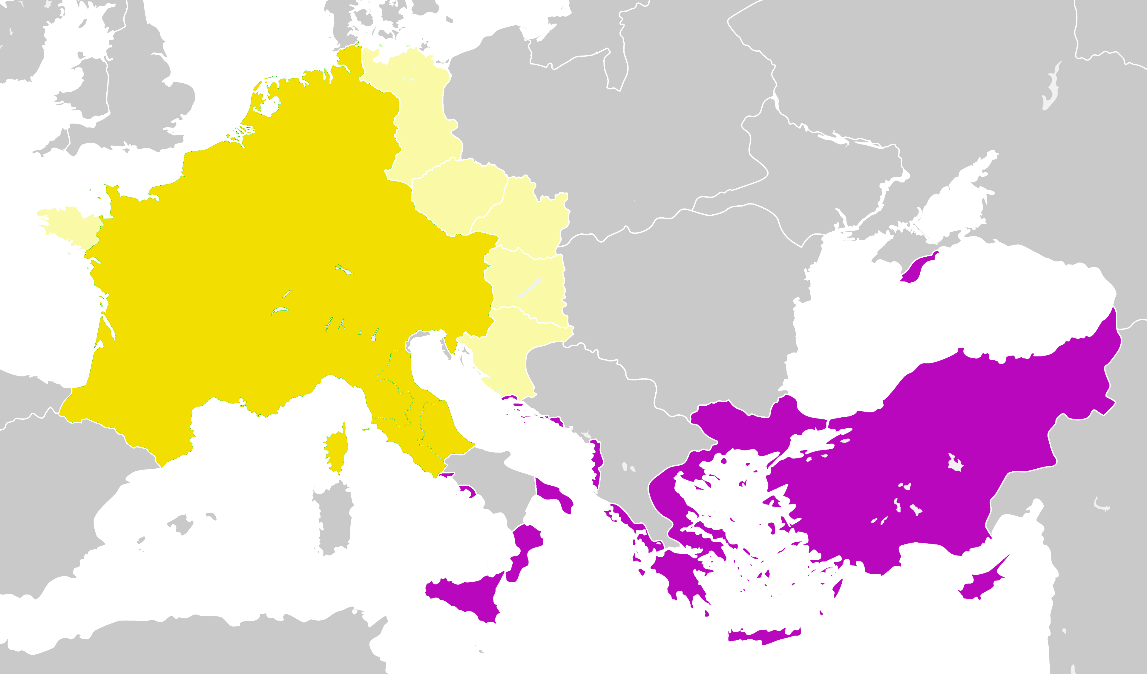
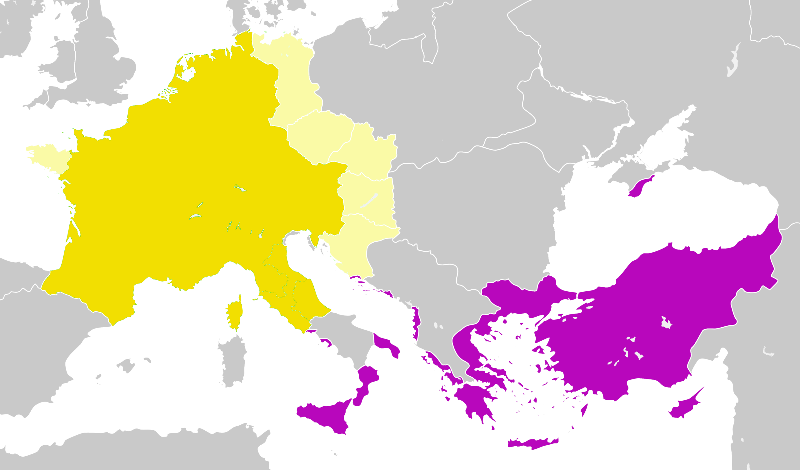
English: The Carolingian Empire and the Byzantine Empire in 814 AD |
| Date | |
| Source | Francia 814.svg |
| Author |
User:Alphathon User:Ichthyovenator (derivative work forbidden by the rule "COM:CROP" usually applied to old maps scanned, but for the current ones created here, normally we should could improve each other. Since this is not the case for this map, I create another more exact version here Carolingian and Eastern Roman empires 814.png.) |
Licensing
This file is licensed under the Creative Commons Attribution-Share Alike 4.0 International license.
- You are free:
- to share – to copy, distribute and transmit the work
- to remix – to adapt the work
- Under the following conditions:
- attribution – You must give appropriate credit, provide a link to the license, and indicate if changes were made. You may do so in any reasonable manner, but not in any way that suggests the licensor endorses you or your use.
- share alike – If you remix, transform, or build upon the material, you must distribute your contributions under the same or compatible license as the original.
File history
Click on a date/time to view the file as it appeared at that time.
| Date/Time | Thumbnail | Dimensions | User | Comment | |
|---|---|---|---|---|---|
| current | 05:38, 26 January 2022 | | 3,840 × 2,258 (700 KB) | GPinkerton | Reverted to version as of 12:33, 2 January 2020 (UTC) COM:CROP Rules apply to you too |
| 18:19, 31 December 2021 |  | 3,840 × 2,258 (608 KB) | Claude Zygiel | WP:CROP rules are not for restore mistakes, a map must be conform to Historic atlases | |
| 04:36, 27 September 2021 |  | 3,840 × 2,258 (700 KB) | GPinkerton | Reverted to version as of 12:33, 2 January 2020 (UTC) COM:CROP | |
| 14:54, 18 June 2020 |  | 3,840 × 2,258 (597 KB) | Claude Zygiel | Venice: byzantine until 990; Church state: autonomous; Slavs: also in Peloponnesus (Ezerits, Melinges); separate Western from Eastern Slavs, Avarian from Bulgarian states and Etelköz from the Khazarian state; removed the modern dam reservoirs. | |
| 12:33, 2 January 2020 |  | 3,840 × 2,258 (700 KB) | Ichthyovenator | Fixed image being a bit too bright | |
| 21:24, 1 January 2020 |  | 3,840 × 2,258 (688 KB) | Ichthyovenator | User created page with UploadWizard |
File usage
The following pages on the English Wikipedia use this file (pages on other projects are not listed):
Global file usage
The following other wikis use this file:
- Usage on zh.wikipedia.org