
File:CentennialRangeNRCmap cropped.jpg
Size of this preview: 800 × 539 pixels. Other resolutions: 320 × 216 pixels | 640 × 431 pixels | 1,024 × 690 pixels | 1,444 × 973 pixels.
Original file (1,444 × 973 pixels, file size: 2.21 MB, MIME type: image/jpeg)
| This is a file from the Wikimedia Commons. Information from its description page there is shown below. Commons is a freely licensed media file repository. You can help. |
Summary
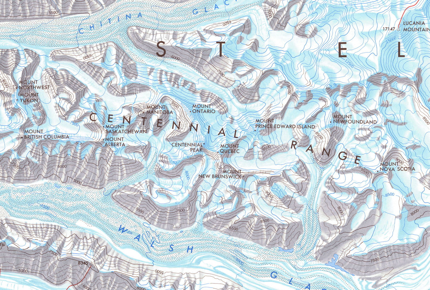
| Description | Cropped Map of the Centennial Range, Yukon, Canada. From Government of Canada; Natural Resources Canada; Earth Sciences Sector; The Atlas of Canada. Series:Atlas of Canada, Various, 1965 to 2006. Issue:MCR 0007 |
| Date | (UTC) |
| Source |
This file was derived from: CentennialRangeNRCmap.jpg:  |
| Author |
|
| This is a retouched picture, which means that it has been digitally altered from its original version. Modifications: Cropped to detail Centennial Range. The original can be viewed here: CentennialRangeNRCmap.jpg:
|
Licensing
I, the copyright holder of this work, hereby publish it under the following license:

|
The copyright holder of this file allows anyone to use it for any purpose, provided that the copyright holder is properly attributed. Redistribution, derivative work, commercial use, and all other use is permitted. |
|
|
Original upload log
This image is a derivative work of the following images:
- File:CentennialRangeNRCmap.jpg licensed with Attribution
- 2013-03-22T05:01:54Z The Interior 4563x5151 (3746728 Bytes) {{Information |Description=Map of the Centennial Range, Yukon, Canada. From Government of Canada; Natural Resources Canada; Earth Sciences Sector; The Atlas of Canada. Series:Atlas of Canada, Various, 1965 to 2006. Issue:MCR
Uploaded with derivativeFX
File history
Click on a date/time to view the file as it appeared at that time.
| Date/Time | Thumbnail | Dimensions | User | Comment | |
|---|---|---|---|---|---|
| current | 05:19, 22 March 2013 | | 1,444 × 973 (2.21 MB) | The Interior | == {{int:filedesc}} == {{Information |Description=Cropped Map of the Centennial Range, Yukon, Canada. From Government of Canada; Natural Resources Canada; Earth Sciences Sector; The Atlas of Canada. Series:Atlas of Canada, Various, 1965 to 2006. Issue:... |
File usage
The following pages on the English Wikipedia use this file (pages on other projects are not listed):
Global file usage
The following other wikis use this file:
- Usage on ja.wikipedia.org