
File:Chadiza town district location.PNG
Size of this preview: 800 × 554 pixels. Other resolutions: 320 × 222 pixels | 640 × 443 pixels | 908 × 629 pixels.
Original file (908 × 629 pixels, file size: 102 KB, MIME type: image/png)
| This is a file from the Wikimedia Commons. Information from its description page there is shown below. Commons is a freely licensed media file repository. You can help. |
Summary
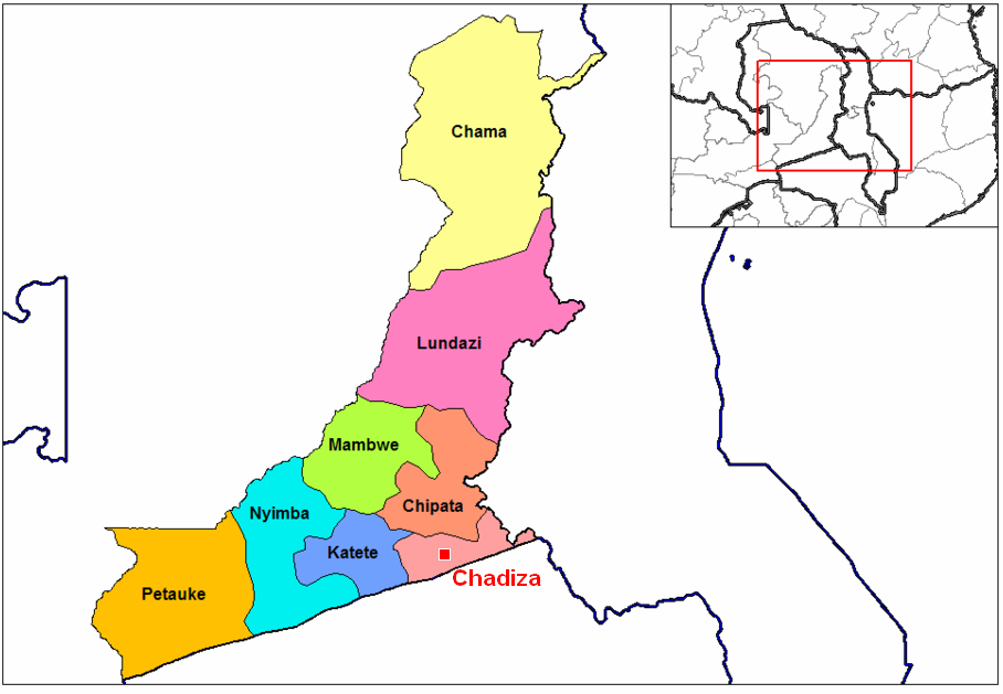
| Description | Chadiza town & district location map |
| Date | |
| Source | self-made based on Image:Eastern Zambia districts.png by User:Rarelibra (public domain) |
| Author | revision by MyName (Rexparry sydney) |
| Other versions | Similar to Image:Eastern Zambia districts.png |
Licensing
| I, the copyright holder of this work, release this work into the public domain. This applies worldwide. In some countries this may not be legally possible; if so: I grant anyone the right to use this work for any purpose, without any conditions, unless such conditions are required by law. |
File history
Click on a date/time to view the file as it appeared at that time.
| Date/Time | Thumbnail | Dimensions | User | Comment | |
|---|---|---|---|---|---|
| current | 10:48, 21 April 2007 | | 908 × 629 (102 KB) | Rexparry sydney~commonswiki | == Summary == {{Information |Description=Chadiza town & district location map |Source=self-made based on Image:Eastern Zambia districts.png (public domain) |Date=20-4-07 |Author= MyName (Rexparry sydney) |other_versions=Based on |
File usage
The following pages on the English Wikipedia use this file (pages on other projects are not listed):
Global file usage
The following other wikis use this file:
- Usage on tum.wikipedia.org
- Usage on zh.wikipedia.org
- Usage on zu.wikipedia.org