
File:Chapelle ND de Port-Blanc.jpg

Size of this preview: 800 × 533 pixels. Other resolutions: 320 × 213 pixels | 640 × 427 pixels.
Original file (900 × 600 pixels, file size: 253 KB, MIME type: image/jpeg)
| This is a file from the Wikimedia Commons. Information from its description page there is shown below. Commons is a freely licensed media file repository. You can help. |
|
This building is indexed in the base Mérimée, a database of architectural heritage maintained by the French Ministry of Culture, under the reference PA00089372
|
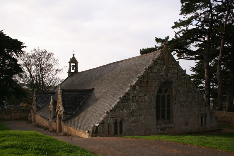
| Description | la chapelle Notre-Dame de Port-Blanc à demi enterrée date du 16ème siècle. Elle est bâtie sur les fondations d’une tour de guet du 13ème siècle sur la commune de Penvénan dans les Côtes-d'Armor. | ||
| Date | |||
| Source | flickr | ||
| Author | timtom.ch | ||
| Permission (Reusing this file) |
This file is licensed under the Creative Commons Attribution-Share Alike 2.0 Generic license.
|
| Object location | | View this and other nearby images on: OpenStreetMap |
|---|
File history
Click on a date/time to view the file as it appeared at that time.
| Date/Time | Thumbnail | Dimensions | User | Comment | |
|---|---|---|---|---|---|
| current | 14:42, 18 March 2007 | | 900 × 600 (253 KB) | Brieg | {{Information |Description= la '''chapelle Notre-Dame de Port-Blanc''' à demi enterrée date du 16ème siècle. Elle est bâtie sur les fondations d’une tour de guet du 13ème siècle sur la commune de Penvénan dans les [[:fr:Côtes- |
File usage
No pages on the English Wikipedia use this file (pages on other projects are not listed).
Global file usage
The following other wikis use this file:
- Usage on br.wikipedia.org
- Usage on de.wikipedia.org
- Usage on es.wikipedia.org
- Usage on fr.wikipedia.org
- Usage on ja.wikipedia.org
- Usage on la.wikipedia.org
- Usage on ms.wikipedia.org
- Usage on sv.wikipedia.org
- Usage on vi.wikipedia.org
- Usage on www.wikidata.org