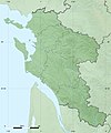
File:Charente-Maritime department location map.svg
Appearance

Size of this PNG preview of this SVG file: 499 × 600 pixels. Other resolutions: 200 × 240 pixels | 399 × 480 pixels | 639 × 768 pixels | 852 × 1,024 pixels | 1,704 × 2,048 pixels | 942 × 1,132 pixels.
Original file (SVG file, nominally 942 × 1,132 pixels, file size: 425 KB)
File history
Click on a date/time to view the file as it appeared at that time.
| Date/Time | Thumbnail | Dimensions | User | Comment | |
|---|---|---|---|---|---|
| current | 02:43, 15 October 2008 |  | 942 × 1,132 (425 KB) | Sting | == Summary == {{Location|45|44|15|N|00|46|30|W|scale:1000000}} <br/> {{Information |Description={{en|Blank administrative map of the department of Charente-Maritime, France, for geo-location purpose, with distinct boundaries for |
File usage
The following 5 pages use this file:
Global file usage
The following other wikis use this file:
- Usage on als.wikipedia.org
- Usage on ar.wikipedia.org
- Usage on ceb.wikipedia.org
- Usage on cs.wikipedia.org
- Usage on cy.wikipedia.org
- Usage on de.wikipedia.org
- Usage on eo.wikipedia.org
- La Rochelle
- Saint-Trojan-les-Bains
- Île-d'Aix
- La Jarrie
- Esnandes
- Ŝablono:Informkesto ponto
- Ŝablono:Informkesto ponto/dokumentado
- Ponto de Oléron
- Rochefort (Charente-Maritime)
- Marennes (Charente-Maritime)
- Ŝablono:Situo sur mapo Francio Charente-Maritime
- Surgères
- Saint-Denis-d'Oléron
- Saint-Pierre-d'Oléron
- Saint-Georges-d'Oléron
- Hiers-Brouage
- Bourcefranc-le-Chapus
- Marsilly (Charente-Maritime)
- Lagord
- L'Houmeau
- Les Mathes
- Saint-Xandre
- La Brée-les-Bains
- Nieul-sur-Mer
- Puilboreau
- Charron (Charente-Maritime)
- Andilly (Charente-Maritime)
- Mornac-sur-Seudre
- Dompierre-sur-Mer
- Sainte-Soulle
- Aytré
- Angoulins
- Châtelaillon-Plage
- Arvert
- Périgny (Charente-Maritime)
View more global usage of this file.


