
File:Chicago, Illinois Gauler Twin Houses 1.jpg
Size of this preview: 800 × 600 pixels. Other resolutions: 320 × 240 pixels | 640 × 480 pixels | 1,024 × 768 pixels | 1,280 × 960 pixels | 2,560 × 1,920 pixels | 3,072 × 2,304 pixels.
Original file (3,072 × 2,304 pixels, file size: 3.01 MB, MIME type: image/jpeg)
| This is a file from the Wikimedia Commons. Information from its description page there is shown below. Commons is a freely licensed media file repository. You can help. |
Summary
| Description |
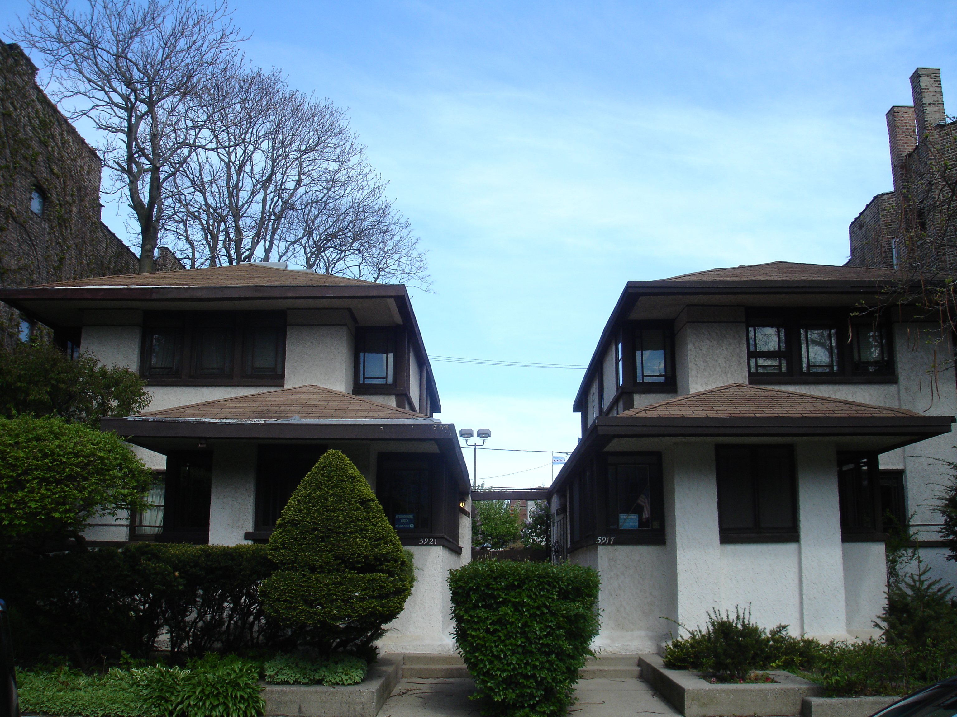
English: Gauler Twin Houses (1908), Walter Burley Griffin, Chicago Landmark, Chicago, Illinois, May 17, 2011: "Built as speculative housing for John Gauler, a Chicago butcher, this pair of wood-and-stucco residences is a rare example of a twin Prairie School design. Their architect, Walter Burley Griffin, is internationally recognized for his distinctive designs, as well as his contributions to the field of "land planning," including his master plan for Canberra, the capital city of Australia. The vertical composition of these houses was a hallmark of Griffin's work and demonstrates his skill in adapting Prairie-style principles to a relatively small, narrow urban site. The houses share a front entrance walkway and their floor plans are mirror images of one another."
Quoted text from: [1] |
| Date | |
| Source | Own work |
| Author | IvoShandor |
| Object location | | View this and other nearby images on: OpenStreetMap |
|---|
Licensing
I, the copyright holder of this work, hereby publish it under the following license:
This file is licensed under the Creative Commons Attribution-Share Alike 3.0 Unported license.
- You are free:
- to share – to copy, distribute and transmit the work
- to remix – to adapt the work
- Under the following conditions:
- attribution – You must give appropriate credit, provide a link to the license, and indicate if changes were made. You may do so in any reasonable manner, but not in any way that suggests the licensor endorses you or your use.
- share alike – If you remix, transform, or build upon the material, you must distribute your contributions under the same or compatible license as the original.
File history
Click on a date/time to view the file as it appeared at that time.
| Date/Time | Thumbnail | Dimensions | User | Comment | |
|---|---|---|---|---|---|
| current | 03:56, 18 May 2011 | | 3,072 × 2,304 (3.01 MB) | IvoShandor |
File usage
The following pages on the English Wikipedia use this file (pages on other projects are not listed):
Global file usage
The following other wikis use this file:
- Usage on www.wikidata.org