
File:Circa 1880 map detail of Rancho Las Cruces plat Las Cruces Hot Springs aka Gaviota Hot Springs.jpg

Size of this preview: 600 × 600 pixels. Other resolutions: 240 × 240 pixels | 612 × 612 pixels.
Original file (612 × 612 pixels, file size: 121 KB, MIME type: image/jpeg)
| This is a file from the Wikimedia Commons. Information from its description page there is shown below. Commons is a freely licensed media file repository. You can help. |
Summary
| Description |
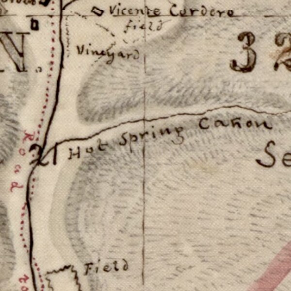
English: Circa 1880 map detail of Rancho Las Cruces plat Las Cruces Hot Springs aka Gaviota Hot Springs |
| Date | |
| Source |
Title: Map of lands claimed by Rancho Las Cruces : Santa Barbara County, Cal Local Call Number: Land Case Map D-934 From: Map of lands claimed by Rancho Las Cruces : Santa Barbara County, Cal Collection: Maps of private land grant cases of California Contributing Institution: UC Berkeley, Bancroft Library https://oac.cdlib.org/ark:/13030/hb1t1nb0gk/?order=2&brand=oac4 |
| Author | US Surveyor General |
Licensing
This work is in the public domain in the United States because it was published (or registered with the U.S. Copyright Office) before January 1, 1929.
Public domain works must be out of copyright in both the United States and in the source country of the work in order to be hosted on the Commons. If the work is not a U.S. work, the file must have an additional copyright tag indicating the copyright status in the source country.
Note: This tag should not be used for sound recordings. |
This work is in the public domain in the United States because it is a work prepared by an officer or employee of the United States Government as part of that person’s official duties under the terms of Title 17, Chapter 1, Section 105 of the US Code.
Note: This only applies to original works of the Federal Government and not to the work of any individual U.S. state, territory, commonwealth, county, municipality, or any other subdivision. This template also does not apply to postage stamp designs published by the United States Postal Service since 1978. (See § 313.6(C)(1) of Compendium of U.S. Copyright Office Practices). It also does not apply to certain US coins; see The US Mint Terms of Use.
|
 | |
| This file has been identified as being free of known restrictions under copyright law, including all related and neighboring rights. | ||
File history
Click on a date/time to view the file as it appeared at that time.
| Date/Time | Thumbnail | Dimensions | User | Comment | |
|---|---|---|---|---|---|
| current | 03:04, 21 January 2024 | | 612 × 612 (121 KB) | Jengod | Uploaded a work by US Surveyor General from Title: Map of lands claimed by Rancho Las Cruces : Santa Barbara County, Cal Local Call Number: Land Case Map D-934 From: Map of lands claimed by Rancho Las Cruces : Santa Barbara County, Cal Collection: Maps of private land grant cases of California Contributing Institution: UC Berkeley, Bancroft Library https://oac.cdlib.org/ark:/13030/hb1t1nb0gk/?order=2&brand=oac4 with UploadWizard |
File usage
The following pages on the English Wikipedia use this file (pages on other projects are not listed):