
File:Cup and ring marked rocks near Drumtroddan farm - geograph.org.uk - 88204.jpg
Size of this preview: 800 × 600 pixels. Other resolutions: 320 × 240 pixels | 640 × 480 pixels | 1,024 × 768 pixels | 1,280 × 960 pixels | 1,600 × 1,200 pixels.
Original file (1,600 × 1,200 pixels, file size: 432 KB, MIME type: image/jpeg)
| This is a file from the Wikimedia Commons. Information from its description page there is shown below. Commons is a freely licensed media file repository. You can help. |
Summary
| Description |
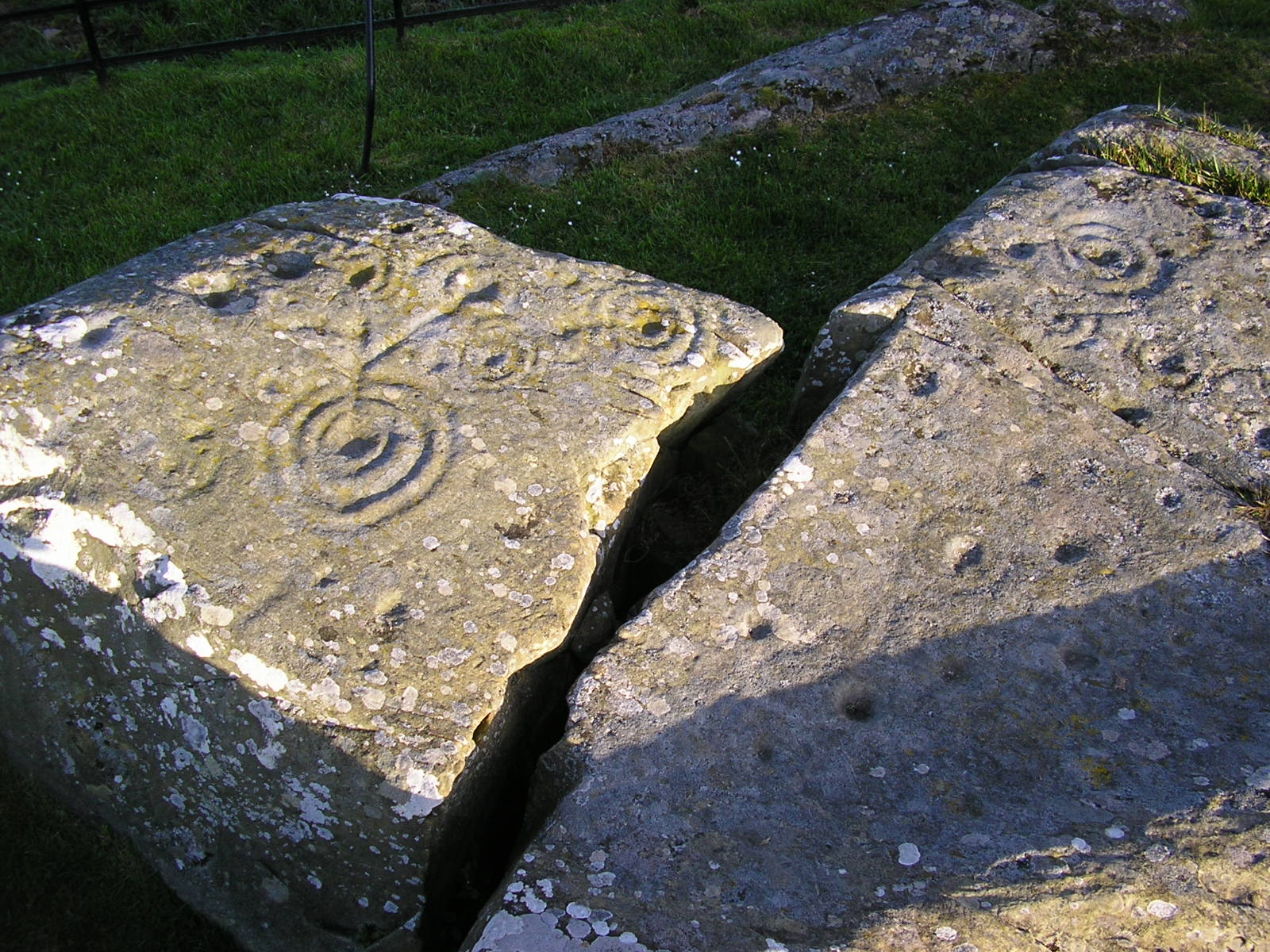
English: Cup and ring marked rocks near Drumtroddan farm. |
| Date | |
| Source | From geograph.org.uk |
| Author | Roger W Haworth |
| Attribution (required by the license) | Roger W Haworth / Cup and ring marked rocks near Drumtroddan farm / |
| Object location | | View this and other nearby images on: OpenStreetMap |
|---|
_&language=en)
Licensing

|
This image was taken from the Geograph project collection. See this photograph's page on the Geograph website for the photographer's contact details. The copyright on this image is owned by Roger W Haworth and is licensed for reuse under the Creative Commons Attribution-ShareAlike 2.0 license.
|
This file is licensed under the Creative Commons Attribution-Share Alike 2.0 Generic license.
Attribution: Roger W Haworth
- You are free:
- to share – to copy, distribute and transmit the work
- to remix – to adapt the work
- Under the following conditions:
- attribution – You must give appropriate credit, provide a link to the license, and indicate if changes were made. You may do so in any reasonable manner, but not in any way that suggests the licensor endorses you or your use.
- share alike – If you remix, transform, or build upon the material, you must distribute your contributions under the same or compatible license as the original.
File history
Click on a date/time to view the file as it appeared at that time.
| Date/Time | Thumbnail | Dimensions | User | Comment | |
|---|---|---|---|---|---|
| current | 23:46, 17 March 2010 | | 1,600 × 1,200 (432 KB) | RHaworth | bigger image |
| 20:48, 30 January 2010 |  | 640 × 480 (152 KB) | GeographBot | == {{int:filedesc}} == {{Information |description={{en|1=Cup and ring marked rocks near Drumtroddan farm.}} |date=2005-05-21 |source=From [http://www.geograph.org.uk/photo/88204 geograph.org.uk] |author=[http://www.geograph.org.uk/profile/3860 Roger W Haw |
File usage
The following pages on the English Wikipedia use this file (pages on other projects are not listed):
Global file usage
The following other wikis use this file:
- Usage on de.wikipedia.org
- Usage on nl.wikipedia.org
- Usage on www.wikidata.org