
File:D-day allied assault routes map.jpg

Size of this preview: 800 × 557 pixels. Other resolutions: 320 × 223 pixels | 640 × 445 pixels | 1,024 × 713 pixels | 1,280 × 891 pixels | 1,565 × 1,089 pixels.
Original file (1,565 × 1,089 pixels, file size: 408 KB, MIME type: image/jpeg)
| This is a file from the Wikimedia Commons. Information from its description page there is shown below. Commons is a freely licensed media file repository. You can help. |
Summary
| Description |
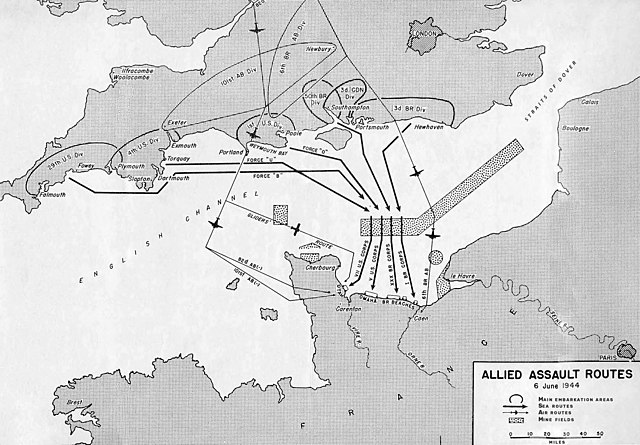
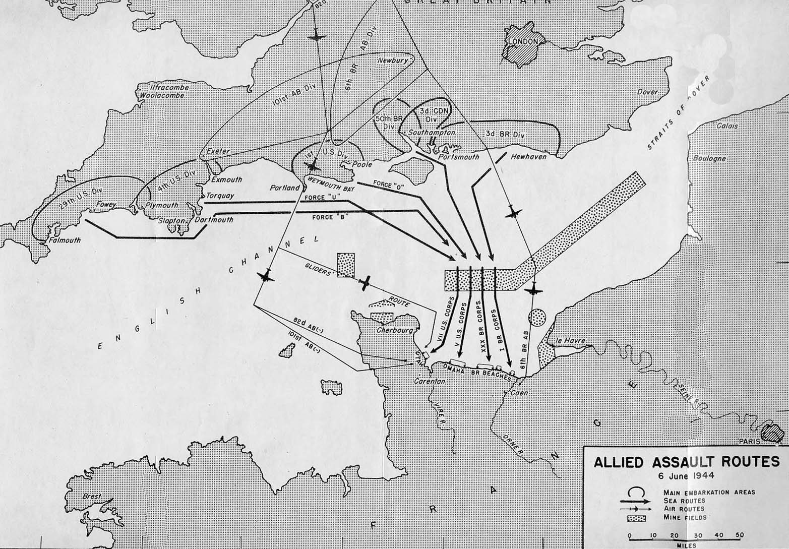
Français : Plan d'attaque du débarquement en Normandie
From Center for Military History, US Army (http://www.army.mil/cmh-pg/BOOKS/WWII/utah/maps/Map2.jpg) Originally prepared as part of the US Military History: Utah Beach To Cherbourg |
| Source | |
| Author |
Licensing
This file is a work of a U.S. Army soldier or employee, taken or made as part of that person's official duties. As a work of the U.S. federal government, it is in the public domain in the United States.
|
 |
Original upload log
The original description page was here. All following user names refer to fr.wikipedia.
- 2004-06-05 11:36 Yann 1565×1089× (412199 bytes) Plan d'attaque du débarquement en Normandie
File history
Click on a date/time to view the file as it appeared at that time.
| Date/Time | Thumbnail | Dimensions | User | Comment | |
|---|---|---|---|---|---|
| current | 20:15, 23 December 2020 | | 1,565 × 1,089 (408 KB) | F l a n k e r | little bit of cleanup |
| 16:56, 15 October 2009 |  | 1,565 × 1,089 (403 KB) | Korribot | {{BotMoveToCommons|fr.wikipedia|year={{subst:CURRENTYEAR}}|month={{subst:CURRENTMONTHNAME}}|day={{subst:CURRENTDAY}}}} {{Information |Description={{fr|Plan d'attaque du débarquement en Normandie == Source == From Center for Military History, US Army |
File usage
The following pages on the English Wikipedia use this file (pages on other projects are not listed):
Global file usage
The following other wikis use this file:
- Usage on cs.wikipedia.org
- Usage on fr.wikipedia.org
- Usage on it.wikipedia.org
- Usage on lmo.wikipedia.org
- Usage on www.wikidata.org