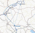
File:Donauversinkung-Schema.png
Appearance
Donauversinkung-Schema.png (574 × 548 pixels, file size: 222 KB, MIME type: image/png)
File history
Click on a date/time to view the file as it appeared at that time.
| Date/Time | Thumbnail | Dimensions | User | Comment | |
|---|---|---|---|---|---|
| current | 08:27, 15 December 2014 |  | 574 × 548 (222 KB) | RokerHRO | optipng -o7 → 39.66% decrease |
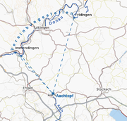
| 11:07, 23 July 2010 |  | 574 × 548 (368 KB) | Chriusha | Tuttlinger Versinkung, da nicht nachgewiesen, entfernt. | |
| 20:59, 16 September 2009 |  | 574 × 548 (342 KB) | Kreuzschnabel | Straßen verblaßt, Flußläufe hervorgehoben | |
| 21:25, 15 September 2009 |  | 574 × 548 (344 KB) | Kreuzschnabel | {{Information |Description={{de|1=Schematische Karte der Donauversinkung}} |Source=Eigenes Werk (own work) |Author=Kreuzschnabel |Date=2009-09-15 |Permission= |other_versions= }} Category:Danube sink |
File usage
The following page uses this file:
Global file usage
The following other wikis use this file:
- Usage on cs.wikipedia.org
- Usage on de.wikipedia.org
- Usage on de.wikivoyage.org
- Usage on fr.wikipedia.org
- Usage on lb.wikipedia.org
- Usage on nl.wikipedia.org
- Usage on pl.wikipedia.org
- Usage on sl.wikipedia.org
- Usage on uk.wikipedia.org


