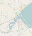
File:DuluthMapRevised.png
Appearance

Size of this preview: 544 × 600 pixels. Other resolutions: 218 × 240 pixels | 435 × 480 pixels | 697 × 768 pixels | 929 × 1,024 pixels | 1,896 × 2,090 pixels.
Original file (1,896 × 2,090 pixels, file size: 1.69 MB, MIME type: image/png)
File history
Click on a date/time to view the file as it appeared at that time.
| Date/Time | Thumbnail | Dimensions | User | Comment | |
|---|---|---|---|---|---|
| current | 21:52, 8 August 2011 |  | 1,896 × 2,090 (1.69 MB) | Dulufoto |
File usage
The following 39 pages use this file:
- Bergetta Moe Bakery
- Bridge 5757
- Bridge L6113
- Bridge L8515
- Chester Terrace (Duluth, Minnesota)
- DeWitt–Seitz Building
- Downtown Duluth
- Duluth Armory
- Duluth Civic Center Historic District
- Duluth Masonic Center
- Duluth Public Library (historic)
- Endion School
- Endion station
- Hartley Building
- Irving School (Duluth, Minnesota)
- Kitchi Gammi Club
- Lester River Bridge
- Lester River Fish Hatchery
- Lincoln Branch Library
- Mayflower (scow-schooner)
- Munger Terrace
- Oliver G. Traphagen House
- SS William A. Irvin
- Sacred Heart Cathedral, Sacred Heart School and Christian Brothers Home
- St. Mark's African Methodist Episcopal Church
- Stewart Creek Bridge
- Thomas Wilson (shipwreck)
- U.S. Army Corps of Engineers Duluth Vessel Yard
- USS Essex (1874)
- Wirth Building
- YWCA of Duluth
- User:Dulufoto/Enger Park
- User:Dulufoto/Magney-Snively Natural Area
- User:Dulufoto/Norton Park
- User:Dulufoto/sandbox
- User:GreatLakesShips/sandbox/Overhauls/Archive 1
- User:McGhiever/draft
- Module:Location map/data/USA Minnesota Duluth
- Module:Location map/data/USA Minnesota Duluth/doc
Global file usage
The following other wikis use this file:
- Usage on ar.wikipedia.org
- Usage on ceb.wikipedia.org
- Usage on da.wikipedia.org
- Usage on fr.wikipedia.org
- Usage on kn.wikipedia.org
- Usage on si.wikipedia.org
- Usage on tr.wikipedia.org
- Usage on war.wikipedia.org
